File:Tempsford Bridge - Geograph - 643803.jpg

From Roader's Digest: The SABRE Wiki
Jump to navigation Jump to search

Tempsford_Bridge_-_Geograph_-_643803.jpg(640 × 491 pixels, file size: 61 KB, MIME type: image/jpeg)

Y topleft.gifY topright.gif
Description:
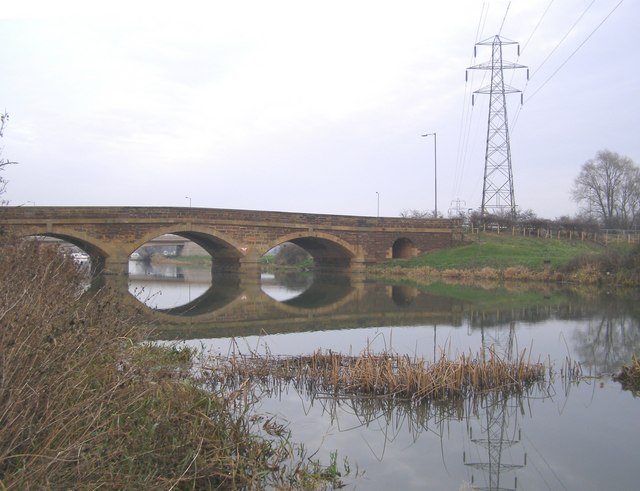
Tempsford Bridge
The 'original' Tempsford Bridge in the foreground is not wide/safe enough for two-way traffic - with a double bend in the vicinity as well. Although a two-lane carriageway, this bridge has been supplemented by another modern bridge (carrying south-bound traffic) which was constructed a short distance downstream; perhaps just visible through an arch. The river is the Great Ouse.
Location:52.176550, -0.303545
Road:A1
Date:22 12 2007
Photographer:� Copyright Brian Green and licensed for reuse under this Creative Commons Licence
Source:Geograph

Map

Y btmleft.gifY btmright.gif

Galleries  | A1 | D2 | Tempsford Bridge | A1 London - Peterborough

File history

Click on a date/time to view the file as it appeared at that time.

Date/TimeThumbnailDimensionsUserComment
current13:25, 23 June 2010Thumbnail for version as of 13:25, 23 June 2010640 × 491 (61 KB)Bob@romiley1 (talk | contribs)'''Tempsford Bridge'''<br/>The 'original' Tempsford Bridge in the foreground is not wide/safe enough for two-way traffic - with a double bend in the vicinity as well. Although a two-lane carriageway, this bridge has been supplemented by another modern br

The following page uses this file:

Metadata

SABRE - The Society for All British and Irish Road Enthusiasts
Discuss - Digest - Discover - Help