File:The A510 descending Ryebury Hill (C) Will Lovell - Geograph - 229067.jpg

From Roader's Digest: The SABRE Wiki
Jump to navigation Jump to search

The_A510_descending_Ryebury_Hill_(C)_Will_Lovell_-_Geograph_-_229067.jpg(640 × 480 pixels, file size: 70 KB, MIME type: image/jpeg)

Y topleft.gifY topright.gif
Description:
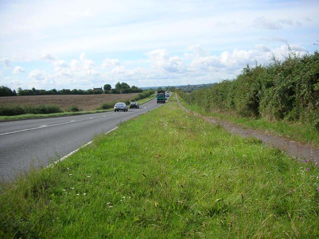
The A510 descending Ryebury Hill (C) Will Lovell
This gentle slope passes for a hill in these parts. Ryebury Farm is seen on the left. The town on the horizon is Wellingborough. The side-walk doubles as a cycle track.
Location:52.325012, -0.661784
Road:A510
Date:30 08 2006
Photographer:Will Lovell and licensed for reuse under this Creative Commons Licence
Source:Geograph

Map

Y btmleft.gifY btmright.gif

Galleries  | A510

File history

Click on a date/time to view the file as it appeared at that time.

Date/TimeThumbnailDimensionsUserComment
current21:04, 17 February 2014Thumbnail for version as of 21:04, 17 February 2014640 × 480 (70 KB)Vlad (talk | contribs)'''The A510 descending Ryebury Hill (C) Will Lovell '''<br/>This gentle slope passes for a hill in these parts. Ryebury Farm is seen on the left. The town on the horizon is Wellingborough. The side-walk doubles as a cycle track.

The following 2 pages use this file:

Metadata

SABRE - The Society for All British and Irish Road Enthusiasts
Discuss - Digest - Discover - Help