File:The B4000 and downland between Ashbury and Lambourn - Geograph - 918572.jpg

From Roader's Digest: The SABRE Wiki
Jump to navigation Jump to search

The_B4000_and_downland_between_Ashbury_and_Lambourn_-_Geograph_-_918572.jpg(640 × 480 pixels, file size: 136 KB, MIME type: image/jpeg)

Y topleft.gifY topright.gif
Description:
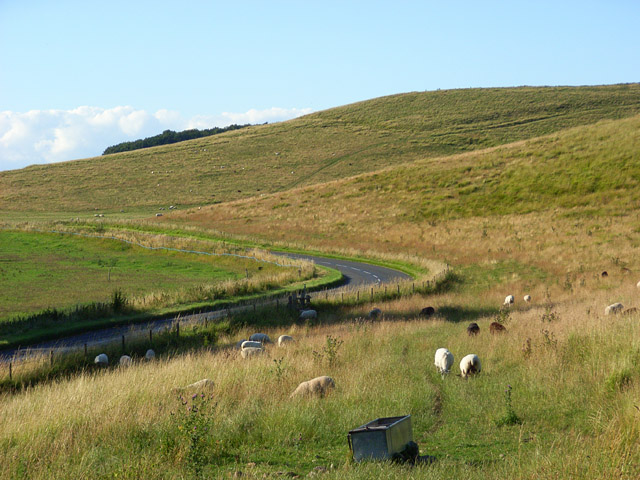
The B4000 and downland between Ashbury and Lambourn
The road passes through one of the more scenic areas of the Berkshire Downs. This is the southern end of the access land on Weathercock Hill's western side.
Location:51.531683, -1.587649
Road:B4000
Date:02 08 2008
Photographer:� Copyright Andrew Smith and licensed for reuse under this Creative Commons Licence
Source:Geograph

Map

Y btmleft.gifY btmright.gif

Galleries  | B4000

File history

Click on a date/time to view the file as it appeared at that time.

Date/TimeThumbnailDimensionsUserComment
current13:42, 8 March 2010Thumbnail for version as of 13:42, 8 March 2010640 × 480 (136 KB)Jeni (talk | contribs)'''The B4000 and downland between Ashbury and Lambourn'''<br/>The road passes through one of the more scenic areas of the Berkshire Downs. This is the southern end of the access land on Weathercock Hill's western side.

The following 2 pages use this file:

Metadata

SABRE - The Society for All British and Irish Road Enthusiasts
Discuss - Digest - Discover - Help