File:The Barony Church (C) Ian Calderwood - Geograph - 2928666.jpg
Jump to navigation
Jump to search

No higher resolution available.
The_Barony_Church_(C)_Ian_Calderwood_-_Geograph_-_2928666.jpg (640 × 480 pixels, file size: 74 KB, MIME type: image/jpeg)
| |||||||||||||||||||||||||
|
Galleries | B928 | ||
File history
Click on a date/time to view the file as it appeared at that time.
| Date/Time | Thumbnail | Dimensions | User | Comment | |
|---|---|---|---|---|---|
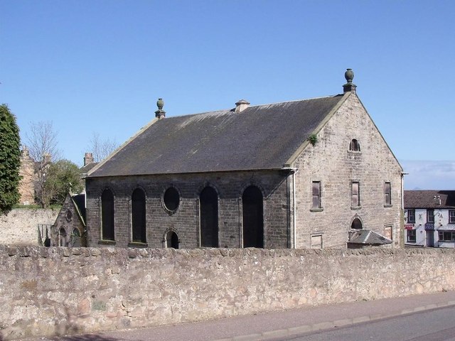
| current | 18:28, 15 April 2015 | | 640 × 480 (74 KB) | Vlad (talk | contribs) | '''The Barony Church (C) Ian Calderwood '''<br/>The Barony was built in 1802. It closed as a church in 1972, when the congregation was merged with that of St Serf's, nearby. It became a YMCA for a while but is now disused and semi-derelict. |
File usage
The following 2 pages use this file:
_Ian_Calderwood_-_Geograph_-_2928666.jpg&oldid=397020)