File:The Black Bull, Cockermouth - Geograph - 4201072.jpg
Jump to navigation
Jump to search

Size of this preview: 399 × 599 pixels. Other resolution: 426 × 640 pixels.
Original file (426 × 640 pixels, file size: 79 KB, MIME type: image/jpeg)
| |||||||||||||||||||||||||
|
Galleries | B5292 | Cockermouth | ||
File history
Click on a date/time to view the file as it appeared at that time.
| Date/Time | Thumbnail | Dimensions | User | Comment | |
|---|---|---|---|---|---|
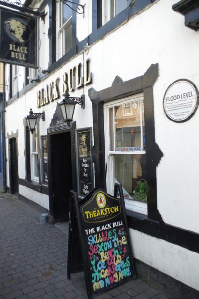
| current | 21:58, 24 August 2017 | | 426 × 640 (79 KB) | Tom h (talk | contribs) | '''The Black Bull, Cockermouth''' Note the astonishingly high flood marker on the wall of this Main Street pub, recalling the unprecedented event of November 2009 when this part of the town was flooded to a depth of 2.5 metres. |
File usage
The following 3 pages use this file: