File:The Blue Bridge at Queensferry - Geograph - 1133368.jpg

From Roader's Digest: The SABRE Wiki
Jump to navigation Jump to search

The_Blue_Bridge_at_Queensferry_-_Geograph_-_1133368.jpg(640 × 480 pixels, file size: 135 KB, MIME type: image/jpeg)

Y topleft.gifY topright.gif
Description:
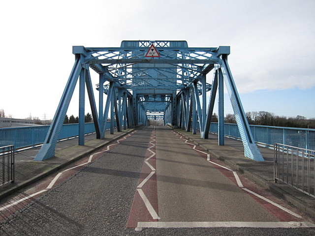
The Blue Bridge at Queensferry
Looking southwest along the B5441 across the bascule type, Queensferry Blue Bridge. The bridge crosses the River Dee and is still a very busy route despite being bypassed by the modern A494(T) route to the east - the empty road in the photo is misleading. The bridge no longer lifts.
Location:53.211024, -3.016076
Road:B5441, Flintshire Leisure Tour
Date:24 01 2009
Photographer:� Copyright John S Turner and licensed for reuse under this Creative Commons Licence
Source:Geograph

Map

Y btmleft.gifY btmright.gif

Galleries  | B5441 | Flintshire Leisure Tour | S2 | The Blue Bridge

File history

Click on a date/time to view the file as it appeared at that time.

Date/TimeThumbnailDimensionsUserComment
current16:59, 28 March 2010Thumbnail for version as of 16:59, 28 March 2010640 × 480 (135 KB)Bob@romiley1 (talk | contribs)'''The Blue Bridge at Queensferry'''<br/>Looking southwest along the B5441 across the bascule type, Queensferry Blue Bridge. The bridge crosses the River Dee and is still a very busy route despite being bypassed by the modern A494(T) route to the east - t

The following 3 pages use this file:

Metadata

SABRE - The Society for All British and Irish Road Enthusiasts
Discuss - Digest - Discover - Help