File:The Cowes Chain Ferry - Geograph - 837142.jpg

From Roader's Digest: The SABRE Wiki
Jump to navigation Jump to search

The_Cowes_Chain_Ferry_-_Geograph_-_837142.jpg(640 × 480 pixels, file size: 173 KB, MIME type: image/jpeg)

Y topleft.gifY topright.gif
Description:
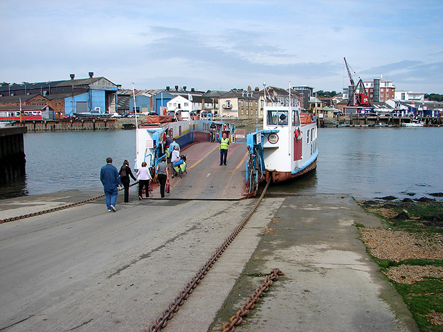
The Cowes Chain Ferry
The ferry is owned and operated by Isle of Wight Council and connects East Cowes & Cowes across the tidal estuary of the River Medina. It was established in 1859 and the current ferry was built in 1975. It is viewed here from the hard at East Cowes.
Location:50.757571, -1.291093
Road:A3021
Date:05 06 2008
Photographer:� Copyright OLU and licensed for reuse under this Creative Commons Licence
Source:Geograph

Map

Y btmleft.gifY btmright.gif

Galleries  | A3021 | Cowes Chain Ferry

File history

Click on a date/time to view the file as it appeared at that time.

Date/TimeThumbnailDimensionsUserComment
current23:43, 20 April 2010Thumbnail for version as of 23:43, 20 April 2010640 × 480 (173 KB)Si404 (talk | contribs)'''The Cowes Chain Ferry'''<br/>The ferry is owned and operated by Isle of Wight Council and connects East Cowes & Cowes across the tidal estuary of the River Medina. It was established in 1859 and the current ferry was built in 1975. It is viewed here fr

The following 3 pages use this file:

Metadata

SABRE - The Society for All British and Irish Road Enthusiasts
Discuss - Digest - Discover - Help