File:The Dunbar Link, Belfast (3) - Geograph - 1716048.jpg
Jump to navigation
Jump to search

No higher resolution available.
The_Dunbar_Link,_Belfast_(3)_-_Geograph_-_1716048.jpg (640 × 390 pixels, file size: 69 KB, MIME type: image/jpeg)
| |||||||||||||||||||||||||
|
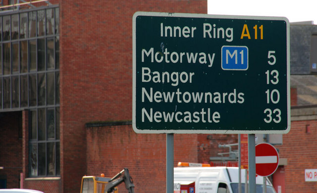
Galleries | A11 (Northern Ireland) | Belfast | Route Confirmation Sign | ||
File history
Click on a date/time to view the file as it appeared at that time.
| Date/Time | Thumbnail | Dimensions | User | Comment | |
|---|---|---|---|---|---|
| current | 20:01, 20 February 2010 | | 640 × 390 (69 KB) | Jeni (talk | contribs) | {{Information |description = The Dunbar Link, Belfast (3) |day = 19 |month = 02 |year = 2010 |photographer = © Copyright [http://www.geograph.org.uk/profile/5835 Aubrey Dale and licensed for reuse under [http://creativecommons.or |
File usage
The following 3 pages use this file:
_-_Geograph_-_1716048.jpg&oldid=171372)