File:The Fingerpost, Pelsall Wood - Geograph - 839288.jpg
Jump to navigation
Jump to search

No higher resolution available.
The_Fingerpost,_Pelsall_Wood_-_Geograph_-_839288.jpg (640 × 472 pixels, file size: 176 KB, MIME type: image/jpeg)
| |||||||||||||||||||||||||
|
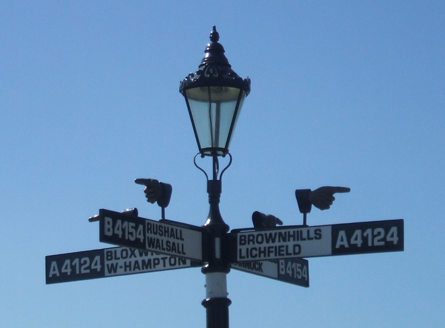
Galleries | A4124 | B4154 | B4155 | The Fingerpost | ||
File history
Click on a date/time to view the file as it appeared at that time.
| Date/Time | Thumbnail | Dimensions | User | Comment | |
|---|---|---|---|---|---|
| current | 06:55, 10 April 2017 | | 640 × 472 (176 KB) | C2r (talk | contribs) | '''The Fingerpost, Pelsall Wood''' A local landmark on the Wolverhampton to Lichfield Road. |
File usage
The following 4 pages use this file: