File:The Kennet and Avon Cycle Route at Marsh... (C) Roger Davies - Geograph - 967351.jpg
Jump to navigation
Jump to search

No higher resolution available.
The_Kennet_and_Avon_Cycle_Route_at_Marsh..._(C)_Roger_Davies_-_Geograph_-_967351.jpg (640 × 426 pixels, file size: 101 KB, MIME type: image/jpeg)
| |||||||||||||||||||||||||
|
Galleries | NCN4 | Fingerpost | ||
File history
Click on a date/time to view the file as it appeared at that time.
| Date/Time | Thumbnail | Dimensions | User | Comment | |
|---|---|---|---|---|---|
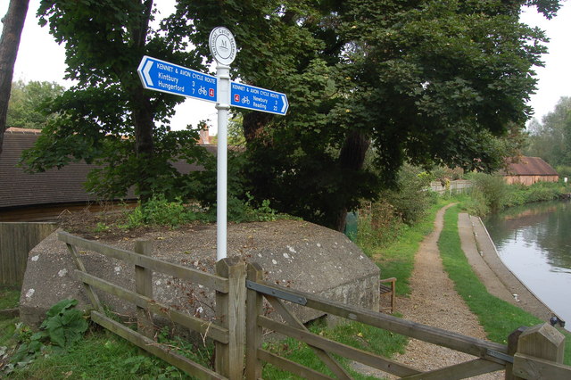
| current | 12:58, 8 March 2014 | | 640 × 426 (101 KB) | Si404 (talk | contribs) | '''The Kennet and Avon Cycle Route at Marsh... (C) Roger Davies '''<br/>View looks eastwards with the Kennet and Avon canal on the right. A WW2 type 22 pillbox is in the foreground on the left. This originally formed part of GHQ Stopline Blue in 1940. |
File usage
There are no pages that use this file.
_Roger_Davies_-_Geograph_-_967351.jpg&oldid=366403)