File:The King's Bridge, Belfast - Geograph - 503711.jpg

From Roader's Digest: The SABRE Wiki
Jump to navigation Jump to search

The_King's_Bridge,_Belfast_-_Geograph_-_503711.jpg(640 × 426 pixels, file size: 78 KB, MIME type: image/jpeg)

Y topleft.gifY topright.gif
Description:
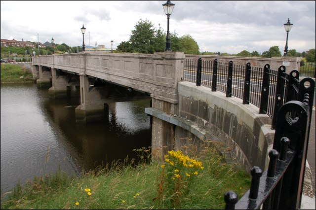
The King's Bridge, Belfast. The King’s Bridge is the “twin”. The view is from the Annadale Embankment towards the Stranmillis Embankment. The Lagan is flowing from left to right.
Location:54.577347, -5.928457
Road:
Date:24 07 2007
Photographer:(c) Copyright Albert Bridge and licensed for reuse under this Creative Commons Licence
Source:Geograph

Map

Y btmleft.gifY btmright.gif

Galleries  | Kings Bridge (Belfast) | Concrete Bridges

File history

Click on a date/time to view the file as it appeared at that time.

Date/TimeThumbnailDimensionsUserComment
current22:12, 22 February 2019Thumbnail for version as of 22:12, 22 February 2019640 × 426 (78 KB)Bothar (talk | contribs)'''The King's Bridge, Belfast''' See 432595. The King’s Bridge is the “twin”. The view is from the Annadale Embankment towards the Stranmillis Embankment. The Lagan is flowing from left to right.

The following 2 pages use this file:

Metadata

SABRE - The Society for All British and Irish Road Enthusiasts
Discuss - Digest - Discover - Help