File:The Plough Inn, Kington Langley - Geograph - 1380866.jpg

From Roader's Digest: The SABRE Wiki
Jump to navigation Jump to search

The_Plough_Inn,_Kington_Langley_-_Geograph_-_1380866.jpg(640 × 481 pixels, file size: 115 KB, MIME type: image/jpeg)

Y topleft.gifY topright.gif
Description:The Plough Inn, Kington Langley The building dates back to the 1500s and its reputed that Oliver Cromwell stayed here on his way to attack Malmesbury. The Plough remains one of the commonest pub names in regular use since at least the 16th century.
Location:51.486928, -2.129699
Road:
Date:01 07 2009
Photographer:(c) Copyright Maigheach-gheal and licensed for reuse under this Creative Commons Licence
Source:Geograph

Map

Y btmleft.gifY btmright.gif

Galleries  | Plough Crossroads | Pictures from Geograph | Wiltshire

File history

Click on a date/time to view the file as it appeared at that time.

Date/TimeThumbnailDimensionsUserComment
current12:42, 13 January 2019Thumbnail for version as of 12:42, 13 January 2019640 × 481 (115 KB)C2r (talk | contribs)
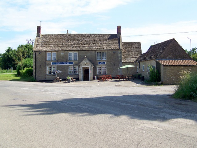
'''The Plough Inn, Kington Langley''' The building dates back to the 1500s and its reputed that Oliver Cromwell stayed here on his way to attack Malmesbury. The Plough remains one of the commonest pub names in regular use since at least the 16th century.

Metadata

SABRE - The Society for All British and Irish Road Enthusiasts
Discuss - Digest - Discover - Help