File:The Queen's Bridge, Lisburn - Geograph - 3797510.jpg
Jump to navigation
Jump to search

No higher resolution available.
The_Queen's_Bridge,_Lisburn_-_Geograph_-_3797510.jpg (640 × 433 pixels, file size: 69 KB, MIME type: image/jpeg)
| |||||||||||||||||||||||||
|
Galleries | Queens Bridge (Lisburn) | Lisburn | Pictures from Geograph | ||
File history
Click on a date/time to view the file as it appeared at that time.
| Date/Time | Thumbnail | Dimensions | User | Comment | |
|---|---|---|---|---|---|
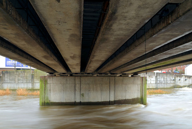
| current | 18:28, 19 September 2021 | | 640 × 433 (69 KB) | C2r (talk | contribs) | '''The Queen's Bridge, Lisburn''' The Queen’s Bridgeconnects the Queen’s Road to the Civic Centre and the towpath. This is the underside with the Lagan high and fast. |
File usage
The following 2 pages use this file: