File:The Queen's Road, Lisburn - Geograph - 573989.jpg
Jump to navigation
Jump to search

No higher resolution available.
The_Queen's_Road,_Lisburn_-_Geograph_-_573989.jpg (640 × 415 pixels, file size: 97 KB, MIME type: image/jpeg)
| |||||||||||||||||||||||||
|
Galleries | A1 (Northern Ireland) | Lisburn | Pictures from Geograph | ||
File history
Click on a date/time to view the file as it appeared at that time.
| Date/Time | Thumbnail | Dimensions | User | Comment | |
|---|---|---|---|---|---|
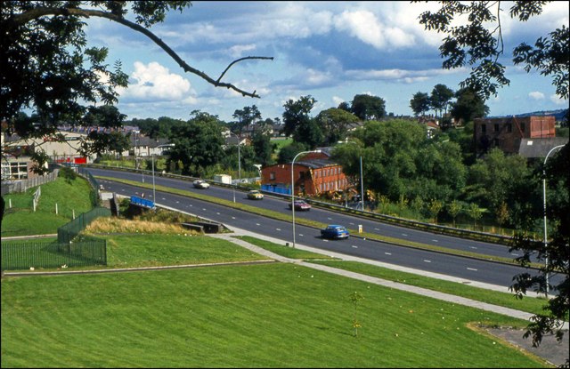
| current | 06:41, 6 September 2021 | | 640 × 415 (97 KB) | C2r (talk | contribs) | '''The Queen's Road, Lisburn''' The Queen’s Road seen from the Castle Gardens. The red buildings in the middle and right are on the Island. They have now been replaced by the Civic Centre . |
File usage
There are no pages that use this file.