File:The River Witham, Langrick - Geograph - 814920.jpg

From Roader's Digest: The SABRE Wiki
Jump to navigation Jump to search

The_River_Witham,_Langrick_-_Geograph_-_814920.jpg(640 × 480 pixels, file size: 95 KB, MIME type: image/jpeg)

Y topleft.gifY topright.gif
Description:
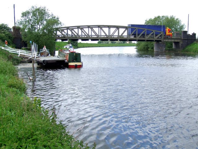
The River Witham, Langrick
This is Langrick Bridge, a narrow bridge which requires one-way crossing, so it is controlled by traffic lights. When crossing a bridge like this, my father used to say (as if it was a new joke), 'This bridge was built to last 100 years ...it expired yesterday.' We always made sure we laughed.
Langrick used to have a railway station way back when passenger trains ran through here from Lincoln to Boston.
Location:53.009752, -0.114094
Road:
Date:13 05 2008
Photographer:� Copyright Dave Hitchborne and licensed for reuse under this Creative Commons Licence
Source:Geograph

Map

Y btmleft.gifY btmright.gif

Galleries  | Langrick Bridge

File history

Click on a date/time to view the file as it appeared at that time.

Date/TimeThumbnailDimensionsUserComment
current16:41, 1 July 2010Thumbnail for version as of 16:41, 1 July 2010640 × 480 (95 KB)Bob@romiley1 (talk | contribs)'''The River Witham, Langrick'''<br/>This is Langrick Bridge, a narrow bridge which requires one-way crossing, so it is controlled by traffic lights. When crossing a bridge like this, my father used to say (as if it was a new joke), "This bridge was built

The following 2 pages use this file:

Metadata

SABRE - The Society for All British and Irish Road Enthusiasts
Discuss - Digest - Discover - Help