File:The South Entrance to the Road Tunnel under Y Maes - Geograph - 289306.jpg
Jump to navigation
Jump to search

No higher resolution available.
The_South_Entrance_to_the_Road_Tunnel_under_Y_Maes_-_Geograph_-_289306.jpg (640 × 480 pixels, file size: 79 KB, MIME type: image/jpeg)
| |||||||||||||||||||||||||
|
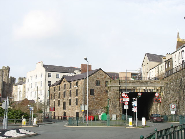
Galleries | Caernarfon Tunnel | Caernarfon | ||
File history
Click on a date/time to view the file as it appeared at that time.
| Date/Time | Thumbnail | Dimensions | User | Comment | |
|---|---|---|---|---|---|
| current | 17:49, 8 March 2010 | | 640 × 480 (79 KB) | Jeni (talk | contribs) | '''The South Entrance to the Road Tunnel under Y Maes'''<br/>This former main line railway tunnel was converted some ten years ago into a road tunnel linking St Helen's Road with North Road.<br /> <a href="http://www.geograph.org.uk/photo/289312">SH4862 |
File usage
The following 4 pages use this file: