File:The Stockport Pyramid from the air (C) Thomas Nugent - Geograph - 4029398.jpg
Jump to navigation
Jump to search

No higher resolution available.
The_Stockport_Pyramid_from_the_air_(C)_Thomas_Nugent_-_Geograph_-_4029398.jpg (640 × 480 pixels, file size: 218 KB, MIME type: image/jpeg)
| |||||||||||||||||||||||||
|
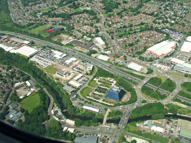
Galleries | A5145 | M60 | A560 | Pyramid Roundabout | Stockport | GSJ | ||
File history
Click on a date/time to view the file as it appeared at that time.
| Date/Time | Thumbnail | Dimensions | User | Comment | |
|---|---|---|---|---|---|
| current | 10:30, 31 October 2014 | | 640 × 480 (218 KB) | Jeni (talk | contribs) | '''The Stockport Pyramid from the air (C) Thomas Nugent '''<br/>A Cooperative Bank call centre by the M60 motorway. See <a href="http://www.geograph.org.uk/photo/2350452">SJ8890 : Stockport Pyramid</a> for details. |
File usage
The following 2 pages use this file:
_Thomas_Nugent_-_Geograph_-_4029398.jpg&oldid=389975)