File:Tudor Bridge, Lostwithiel - Geograph - 666075.jpg

From Roader's Digest: The SABRE Wiki
Jump to navigation Jump to search

Tudor_Bridge,_Lostwithiel_-_Geograph_-_666075.jpg(640 × 442 pixels, file size: 79 KB, MIME type: image/jpeg)

Y topleft.gifY topright.gif
Description:
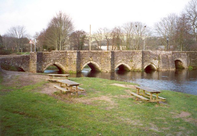
Tudor Bridge, Lostwithiel
First built by the Normans, and rebuilt in stone in the early 14C. Five pointed arches and one round one, on the right, made necessary as the river changed its course. Apparently there were also four arches to the west, now buried under North Street.
Location:50.407471, -4.666827
Road:b3268
Date:07 03 2001
Photographer:� Copyright Humphrey Bolton and licensed for reuse under this Creative Commons Licence
Source:Geograph

Map

Y btmleft.gifY btmright.gif

Galleries  | b3268

File history

Click on a date/time to view the file as it appeared at that time.

Date/TimeThumbnailDimensionsUserComment
current15:26, 1 May 2010Thumbnail for version as of 15:26, 1 May 2010640 × 442 (79 KB)Bob@romiley1 (talk | contribs)'''Tudor Bridge, Lostwithiel'''<br/>First built by the Normans, and rebuilt in stone in the early 14C. Five pointed arches and one round one, on the right, made necessary as the river changed its course. Apparently there were also four arches to the west,

The following 3 pages use this file:

Metadata

SABRE - The Society for All British and Irish Road Enthusiasts
Discuss - Digest - Discover - Help