File:Underpass, Dromore - Geograph - 1129869.jpg
Jump to navigation
Jump to search

No higher resolution available.
Underpass,_Dromore_-_Geograph_-_1129869.jpg (640 × 414 pixels, file size: 74 KB, MIME type: image/jpeg)
| |||||||||||||||||||||||||
|
Galleries | A1 (Northern Ireland) | B2 (Northern Ireland) | Dromore North Interchange | Pictures from Geograph | ||
File history
Click on a date/time to view the file as it appeared at that time.
| Date/Time | Thumbnail | Dimensions | User | Comment | |
|---|---|---|---|---|---|
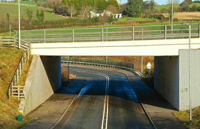
| current | 10:26, 21 October 2020 | | 640 × 414 (74 KB) | C2r (talk | contribs) | '''Underpass, Dromore''' The underpass at the Belfast end of the bypass was completed in 2005. In this view traffic heading from the Hillsborough Road towards Belfast, descends by a 1in10 gradient before reaching the bypass via a tight, speed-restricted, bend. |
File usage
The following page uses this file: