File:Victoria Avenue Bridge (C) Keith Edkins - Geograph - 940577.jpg
Jump to navigation
Jump to search

No higher resolution available.
Victoria_Avenue_Bridge_(C)_Keith_Edkins_-_Geograph_-_940577.jpg (640 × 480 pixels, file size: 70 KB, MIME type: image/jpeg)
| |||||||||||||||||||||||||
|
Galleries | B1047 (Cambridge) | A1131 | unclassified | Cambridge | Arch Bridges | ||
File history
Click on a date/time to view the file as it appeared at that time.
| Date/Time | Thumbnail | Dimensions | User | Comment | |
|---|---|---|---|---|---|
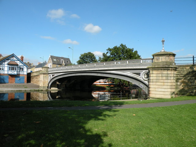
| current | 19:39, 3 June 2014 | | 640 × 480 (70 KB) | Vlad (talk | contribs) | '''Victoria Avenue Bridge (C) Keith Edkins '''<br/>Built in 1889 to provide access from Chesterton village into Cambridge, it was the last bridge downstream for nearly 100 years until the building of Elizabeth Way. |
File usage
The following 5 pages use this file:
_Keith_Edkins_-_Geograph_-_940577.jpg&oldid=376013)