File:Wadebridge bypass viaduct - Geograph - 43671.jpg

From Roader's Digest: The SABRE Wiki
Jump to navigation Jump to search

Wadebridge_bypass_viaduct_-_Geograph_-_43671.jpg(640 × 427 pixels, file size: 85 KB, MIME type: image/jpeg)

Y topleft.gifY topright.gif
Description:
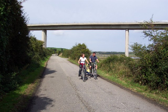
Wadebridge bypass viaduct
The modern A39 road (contrast this with SW9872) soars over the Camel Trail cycle path west of Wadebridge town centre. It was completed in 1993 and saved the town from summer traffic chaos.
Location:50.526498, -4.844276
Road:A39
Date:12 09 2003
Photographer:� Copyright Ron Strutt and licensed for reuse under this Creative Commons Licence
Source:Geograph

Map

Y btmleft.gifY btmright.gif

Galleries  | A39 | Wadebridge | Wadebridge Bypass Viaduct

File history

Click on a date/time to view the file as it appeared at that time.

Date/TimeThumbnailDimensionsUserComment
current17:41, 28 August 2010Thumbnail for version as of 17:41, 28 August 2010640 × 427 (85 KB)Bob@romiley1 (talk | contribs)'''Wadebridge bypass viaduct'''<br/>The modern A39 road (contrast this with SW9872) soars over the Camel Trail cycle path west of Wadebridge town centre. It was completed in 1993 and saved the town from summer traffic chaos.

Metadata

SABRE - The Society for All British and Irish Road Enthusiasts
Discuss - Digest - Discover - Help