File:Waterfall interchange.JPG
Jump to navigation
Jump to search
Size of this preview: 800 × 600 pixels. Other resolution: 1,024 × 768 pixels.
Original file (1,024 × 768 pixels, file size: 176 KB, MIME type: image/jpeg)
File history
Click on a date/time to view the file as it appeared at that time.
| Date/Time | Thumbnail | Dimensions | User | Comment | |
|---|---|---|---|---|---|
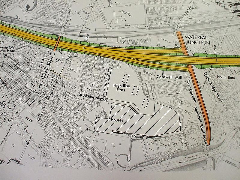
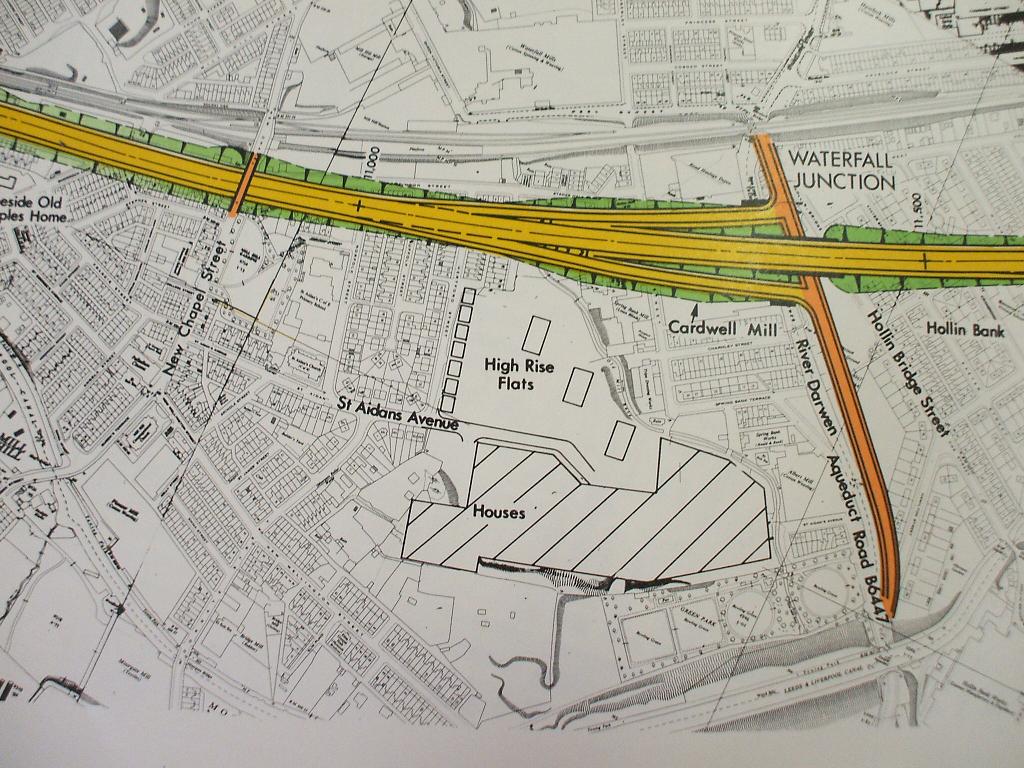
| current | 17:33, 14 February 2010 | | 1,024 × 768 (176 KB) | Bryn666 (talk | contribs) | {{Information |description = Waterfall Interchange engineering diagram |day = |month = |year = 2008 |photographer = Bryn Buck |source = Lancashire Records Office |road = M65 |road2 = B6447 |road3 = | |
File usage
The following 2 pages use this file: