File:West End - Geograph - 55507.jpg
Jump to navigation
Jump to search

No higher resolution available.
West_End_-_Geograph_-_55507.jpg (640 × 480 pixels, file size: 69 KB, MIME type: image/jpeg)
| |||||||||||||||||||||||||
File history
Click on a date/time to view the file as it appeared at that time.
| Date/Time | Thumbnail | Dimensions | User | Comment | |
|---|---|---|---|---|---|
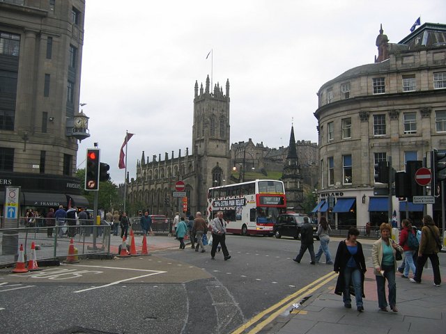
| current | 01:20, 24 February 2021 | | 640 × 480 (69 KB) | Tam nugent (talk | contribs) | A damp Saturday afternoon at the very busy road junction at the west end of Princes Street. The junction has been realigned allowing some traffic (buses and bikes) to leave Queensferry Street for the first time in about 30 years. This is part of a new traffic management system which is extremely unpopular, yet has reduced traffic in some New Town Streets and boosted property values. View to St John's and St Cuthbert's (right) churches with the castle between. Mammon represented by Fraser's d... |
File usage
The following 2 pages use this file: