File:Western Esplanade - Geograph - 1502627.jpg
Jump to navigation
Jump to search

Size of this preview: 400 × 600 pixels. Other resolution: 427 × 640 pixels.
Original file (427 × 640 pixels, file size: 181 KB, MIME type: image/jpeg)
| |||||||||||||||||||||||||
|
Galleries | A3024 | Southampton | ||
File history
Click on a date/time to view the file as it appeared at that time.
| Date/Time | Thumbnail | Dimensions | User | Comment | |
|---|---|---|---|---|---|
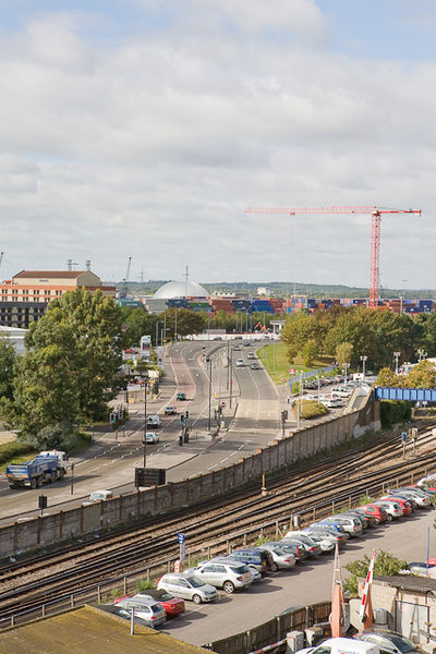
| current | 12:42, 16 April 2010 | | 427 × 640 (181 KB) | Sabristo simon (talk | contribs) | '''Western Esplanade'''<br/>Seen from top of multistorey car park on West Park Road. The silver dome in the distance is on the far side of the River Test at <a href="http://www.geograph.org.uk/photo/1107922">SU3911 : Marchwood Incinerator</a>. |
File usage
The following page uses this file: