File:Where the Halfway House roundabout used to be - Geograph - 2867688.jpg

From Roader's Digest: The SABRE Wiki
Jump to navigation Jump to search

Where_the_Halfway_House_roundabout_used_to_be_-_Geograph_-_2867688.jpg(640 × 428 pixels, file size: 86 KB, MIME type: image/jpeg)

Y topleft.gifY topright.gif
Description:
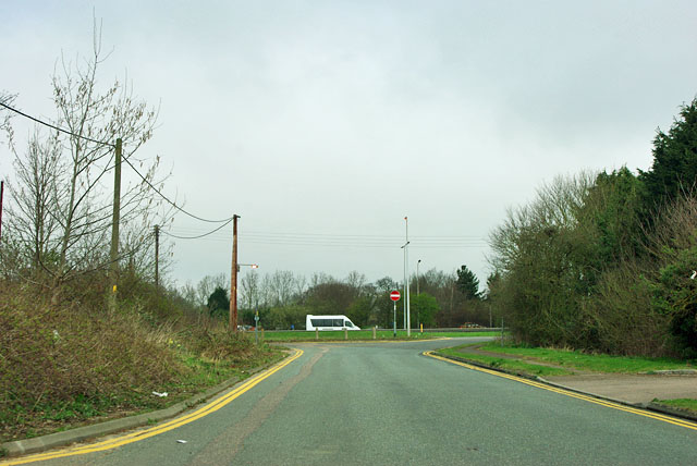
Where the Halfway House roundabout used to be Looking north up the old route of the A128 to where there was originally a roundabout on the A127 Southend Arterial Road where the A128 crossed. Now the junction is grade separated further east. There is no way out ahead. It is possible to enter from the A128 slip road but not directly from the A127.
Location:51.579158, 0.356376
Road:A127, A128
Date:25 03 2012
Photographer:(c) Copyright Robin Webster and licensed for reuse under this Creative Commons Licence
Source:Geograph

Map

Y btmleft.gifY btmright.gif

Galleries  | A127 | A128 | Halfway House (Essex)

File history

Click on a date/time to view the file as it appeared at that time.

Date/TimeThumbnailDimensionsUserComment
current18:46, 10 August 2016Thumbnail for version as of 18:46, 10 August 2016640 × 428 (86 KB)C2r (talk | contribs)'''Where the Halfway House roundabout used to be''' Looking north up the old route of the A128 to where there was originally a roundabout on the A127 Southend Arterial Road where the A128 crossed. Now the junction is grade separated further east. Ther...

The following 2 pages use this file:

Metadata

SABRE - The Society for All British and Irish Road Enthusiasts
Discuss - Digest - Discover - Help