File:Wombourne Bridge No 43 - Geograph - 5206583.jpg
Jump to navigation
Jump to search

No higher resolution available.
Wombourne_Bridge_No_43_-_Geograph_-_5206583.jpg (640 × 451 pixels, file size: 65 KB, MIME type: image/jpeg)
| |||||||||||||||||||||||||
|
Galleries | B4176 | Wombourne Bridge | Wolverhampton | ||
File history
Click on a date/time to view the file as it appeared at that time.
| Date/Time | Thumbnail | Dimensions | User | Comment | |
|---|---|---|---|---|---|
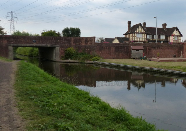
| current | 09:01, 1 April 2020 | | 640 × 451 (65 KB) | Steven (talk | contribs) | '''Wombourne Bridge No 43''' On the right is the Waggon & Horses public house. |
File usage
The following 3 pages use this file: