File:Zeebrugge Ferry Berth - Geograph - 428011.jpg

From Roader's Digest: The SABRE Wiki
Jump to navigation Jump to search

Zeebrugge_Ferry_Berth_-_Geograph_-_428011.jpg(640 × 480 pixels, file size: 65 KB, MIME type: image/jpeg)

Y topleft.gifY topright.gif
Description:
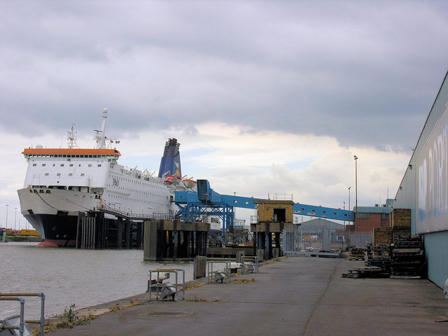
Zeebrugge Ferry Berth
The berth for the overnight ferry to Zeebrugge from King George Dock, showing the passenger linkspan to the ship from the terminal building on the right. The ferry sails at 18.30 daily and arrives at Zeebrugge around 08.30 the next morning.
Location:53.743767, -0.273968
Road:A1033, E20
Date:07 05 2007
Photographer:� Copyright George Robinson and licensed for reuse under this Creative Commons Licence
Source:Geograph

Map

Y btmleft.gifY btmright.gif

Galleries  | A1033 | E20 | Kingston upon Hull | Hull - Zeebrugge ferry

File history

Click on a date/time to view the file as it appeared at that time.

Date/TimeThumbnailDimensionsUserComment
current10:36, 17 August 2010Thumbnail for version as of 10:36, 17 August 2010640 × 480 (65 KB)Abeaton (talk | contribs)'''Zeebrugge Ferry Berth'''<br/>The berth for the overnight ferry to Zeebrugge from King George Dock, showing the passenger linkspan to the ship from the terminal building on the right. The ferry sails at 18.30 daily and arrives at Zeebrugge around 08.30

The following 3 pages use this file:

Metadata

SABRE - The Society for All British and Irish Road Enthusiasts
Discuss - Digest - Discover - Help