Gallery:A1081
From Roader's Digest: The SABRE Wiki
Jump to navigation
Jump to search
A1000-A1099 > A1081
This gallery has no child categories
A1081
St Albans - 08 - The meeting of the zones - Where Sabristis stood on all corners and were in several road zones at once!
Posted by Serena on 10/12/2003
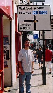
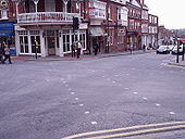
The old A5/A6 Junction, St Albans
Me in front of the former A5/A6 cannon junction in St Albans. I'm standing in Zone 6, across the road is Zone 5, and further right is Zone 4.
Originally uploaded to Coppermine on Sep 30, 2005 by Gareth ThomasPeahen
The diagonal crossing has either been removed or allowed to fade away in recent years - C2r, July 2016.
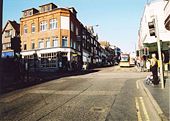
The new diagonal pedestrian crossing at the Peahen junction in St Albans. The viewpoint and the opposite corner are both in Zone 5, Zone 4 is to the right and Zone 6 to the left. The old A5 (now A5183) cannons here to the right, the old A6 (now A1081) to the left Originally uploaded to Coppermine on Apr 12, 2005 by t1(M)
The diagonal crossing has either been removed or allowed to fade away in recent years - C2r, July 2016.
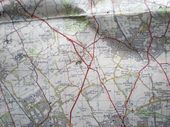
A6 and A1 junction at Bignells Corner near South Mimms in early 1960s around 1965, before M25 (A1146) improvement in 1975
This page contains scans from a map that is believed may be out of copyright according to UK Crown Copyright, UK Copyright Law for other maps published in the United Kingdom, or Irish Government Copyright, is not being used to generate profit in this context, and presents information that cannot be exhibited otherwise.
If the copyright holder considers this is an infringement of their rights, please contact the site management team to discuss further steps.
If the copyright holder considers this is an infringement of their rights, please contact the site management team to discuss further steps.
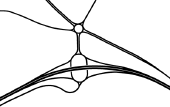
Early plan of Bell Roundabout from the 1970s as part of proposals to complete the M25.
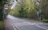
St. Albans Road (C) Martin Addison
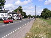
The A1081 looking in the St. Albans direction from the outskirts of Barnet. The speed limit changes here from 30mph to the national speed limit. The bus stop is the last one that Oyster cards are valid to - beyond here you need to buy a ticket on the Uno operated 614 route to Hatfield. This used to be part of the 84 bus route, but that was diverted via Potters Bar in 1989. Sorry there's no bus in the picture...No service on a Sunday!
The A1081 looking in the St. Albans direction from the outskirts of Barnet. The speed limit changes here from 30mph to the national speed limit. The bus stop is the last one that Oyster cards are valid to - beyond here you need to buy a ticket on the Uno operated 614 route to Hatfield. This used to be part of the 84 bus route, but that was diverted via Potters Bar in 1989. Sorry there's no bus in the picture...No service on a Sunday!
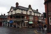
The Peahen Suitably dowdy, especially on a wet December afternoon, The Peahen stands on the corner of London Road and Holywell Hill.
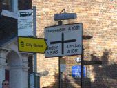
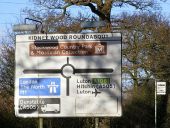
Kidney Wood Roundabout Roadsign Advance Direction Sign on the A1081 London Road, when the junction was a flat roundabout
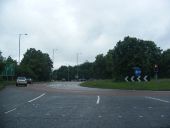
Junction 10a of the M1 at Luton Old layout with large roundabout.
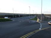
The end of the spur that leads to London Luton Airport comes in from the right. Looking south along the line of the old A6 - now the A1081 to Harpenden.
Hidden categories:
