Gallery:A24

From Roader's Digest: The SABRE Wiki
Jump to navigation Jump to search
A1-A99 > A24


This gallery has no child categories
A24
 
 
A24mickleham.jpg
A24 Mickleham Bypass
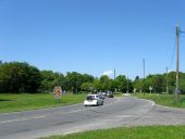
Southbound traffic heading for Worthing - Geograph - 1645442.jpg
Southbound traffic heading for Worthing
A24 Epsom - Coppermine - 22847.JPG
A24 Epsom

Looking south towards the downs.

Originally uploaded to Coppermine on Aug 09, 2009 by DavidNW9
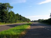
A24 - Coppermine - 20185.jpg
A24

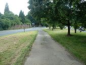
Leatherhead bypass, heading south, Sept 21 2008

Originally uploaded to Coppermine on Oct 04, 2008 by SteveA30
A24 - Coppermine - 20184.jpg
A24

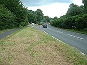
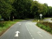
Between Leatherhead and Dorking. The s/bnd side is D1 for about a mile or so. 50 limit.

Originally uploaded to Coppermine on Oct 04, 2008 by SteveA30
A24 - Coppermine - 20180.jpg
A24

Approach to Boxhill s/bnd.

Originally uploaded to Coppermine on Oct 04, 2008 by SteveA30
A24 Mickleham Bends - Coppermine - 17403.jpg
A24 Mickleham Bends

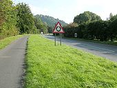
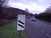
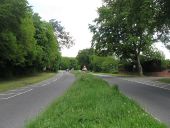
In recent years the nearside lane of the A24 southbound at Mickleham has been hatched out and a 50mph limit introduced. The nortbound carriageway is at far right but retains two lanes.

Originally uploaded to Coppermine on Mar 25, 2008 by multiraider2
Old and new A24's - Coppermine - 13532.jpg
Old and new A24's

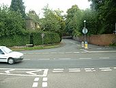
The northern end of the Old London Road, where it meets the A24 at Mickleham.

Originally uploaded to Coppermine on Jun 29, 2007 by SteveA30
A24 - Coppermine - 13531.jpg
A24

Looking SW at the junction of old and new. Is this centre strip part of the original S2 alignment?

Originally uploaded to Coppermine on Jun 29, 2007 by SteveA30
A24 - Coppermine - 13530.jpg
A24

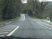
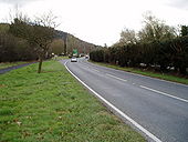
Looking north. The s/bnd side is reduced to D1 all the way from the Leatherhead bypass to a point just after the old road junction.

Originally uploaded to Coppermine on Jun 29, 2007 by SteveA30
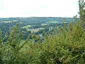
A24 - Coppermine - 13529.jpg
A24

Looking north from the side of Box Hill

Originally uploaded to Coppermine on Jun 29, 2007 by SteveA30
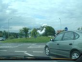
Giant hen - Coppermine - 13465.jpg
Giant hen

I'd heard stories of a giant chicken roaming around Dorking. Yeah right. This is from the A24 crossing the A25, heading north. Hey, what's that over there!

Originally uploaded to Coppermine on Jun 28, 2007 by SteveA30
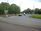
A24 - Coppermine - 13464.jpg
A24

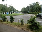
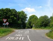
Looking south at the Box Hill rbt. Road on left is named Old London Road. A panel of experts think this may have been the old road to London.

Originally uploaded to Coppermine on Jun 28, 2007 by SteveA30
A24 - Coppermine - 13463.jpg
A24

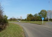
The same rbt. The 2 n/bnd lanes are freeflow past the rbt meaning effectively, the rbt doesn't exist in that direction. Another example of fine 1960's roundabout design. (or 50's perhaps)

Originally uploaded to Coppermine on Jun 28, 2007 by SteveA30
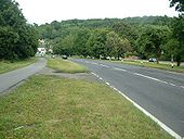
A24 - Coppermine - 13462.jpg
A24

Looking south towards the Box Hill rbt. Slip rd into Ryka's Cafe, a major bikers hangout on Sundays, 500-1000 visitors being commonplace. Not mentioned on the most dangerous roads however. Note lovely central hedge, a common feature on old dual c/ways from the 30's to the 60's. Could do with pruning though.

Originally uploaded to Coppermine on Jun 28, 2007 by SteveA30
A27 Multiplex Worthing - Coppermine - 10297.JPG
A24/A27 Multiplex Worthing

Welcome to the wonderful A27 in Worthing, a road standard most would be envious of.... ;) Wonderful lighting from geared MA60s here making these metal columns sag under the strain. I expect these will remain until Worthing gets its bypass which one day it will...

Originally uploaded to Coppermine on Feb 16, 2007 by Lil
A24 Boxhill - Coppermine - 5015.JPG
A24 Boxhill

This is the end of the 'Mickey bends' section, at the turning for Box Hill itself. Spot the error!

Originally uploaded to Coppermine on Mar 09, 2006 by t1(M)
A24 southbound carriageway - Geograph - 1766722.jpg
A24 southbound carriageway
Slip road to car park for Box Hill and Rykas Cafe leaves the road just before Burford Bridge roundabout.
Tooting Bec Tube - Geograph - 411704.jpg
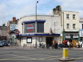
Tooting Bec Tube
Tooting Bec Tube station on the Northern Line, all the stations between South Clapham and Morden are built in this 30s stile of architecture
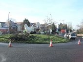
The Giant Chicken Arrives - Geograph - 328599.jpg
The Giant Chicken Arrives
A giant statue of a Dorking Cockerel is installed at the Deepdene Roundabout.
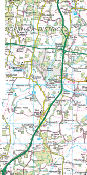
A24 improvements.png
An outline map of the proposed improvements to the A24 that seems to be forever being brought forward, pushed back, cancelled or delayed!
M23 northern end - Coppermine - 170.jpg
M23 northern end

Robemptystage Originally uploaded to Coppermine on Mar 30, 2005 by M4Simon

This page includes a scan of a non-free copyrighted map, and the copyright for it is most likely held by the company or person that produced the map. It is believed that the use of a limited number of web-resolution scans qualifies as fair use under United States copyright law, where this web page is hosted, as such display does not significantly impede the right of the copyright holder to sell the copyrighted material, is not being used to generate profit in this context, and presents information that cannot be exhibited otherwise.
If the copyright holder considers this is an infringement of their rights, please contact the Site Management Team to discuss further steps.
Grade seperated cycleway - Coppermine - 20182.jpg
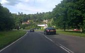
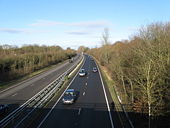
Grade seperated cycleway

Approach to an underpass at Boxhill on the A24

Originally uploaded to Coppermine on Oct 04, 2008 by SteveA30
Split signals - Coppermine - 20567.jpg
Split signals

Clapham South - A24/B237

Originally uploaded to Coppermine on Oct 30, 2008 by RoadKill
Tooting Broadway- A busy intersection (C) Dr Neil Clifton - Geograph - 3540661.jpg
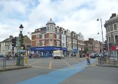
Tooting Broadway- A busy intersection (C) Dr Neil Clifton
This is taken looking diagonally opposite the entrance to the Underground station. The A217 and the A24 cross here. The cyclist, who is on the (blue) Cycling Superhighway (pause for sardonic laughter), will not be pleased to find his way blocked further along Tooting High Street by a large number of parked vehicles.
Cycle Super-highway C57 Tooting Bec (C) David Anstiss - Geograph - 3259901.jpg
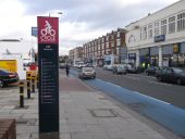
Cycle Super-highway C57 Tooting Bec (C) David Anstiss
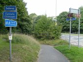
Beside the A24 Balham High Road.

A24 near West Grinstead - Geograph - 2314961.jpg
A24 near West Grinstead
Robin Hood Lane nearing the roundabout on the A 24 - Geograph - 1850780.jpg
Robin Hood Lane nearing the roundabout on the A 24
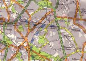
Merantun Way Extension 1990.png
Scan from 1990 A-Z London showing Merantun Way extension proposed. The extension was never built, leaving Merton High Street unbypassed.

This page includes a scan of a non-free copyrighted map, and the copyright for it is most likely held by the company or person that produced the map. It is believed that the use of a limited number of web-resolution scans qualifies as fair use under United States copyright law, where this web page is hosted, as such display does not significantly impede the right of the copyright holder to sell the copyrighted material, is not being used to generate profit in this context, and presents information that cannot be exhibited otherwise.
If the copyright holder considers this is an infringement of their rights, please contact the Site Management Team to discuss further steps.

Roundabout in Chapel Road - Geograph - 1715429.jpg
Roundabout in Chapel Road
Goar Cottages, Findon Valley - Geograph - 3558119.jpg
Goar Cottages, Findon Valley A pair of 18th century flint walled cottages that stand on the corner of Findon Road and Bost Hill and originally used as the village workhouse. Until the 1930s they were virtually the only buildings on the road between Worthing and Findon before being joined by 3551867 in 1823 and eventually becoming engulfed by the newly built suburb of Findon Valley during the 20th century.
Findon By-Pass - Geograph - 3501256.jpg
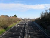
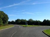
Findon By-Pass Built in 1938 to take motor traffic away from the village's narrow lanes. This section actually uses the course of the old High Street and looks towards the junction s with Cross lane and Nepcote.
Findon Bypass - Geograph - 5870818.jpg
Findon Bypass The A24 seen from a coach.
Highden Bridge - Geograph - 3511460.jpg
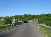
Highden Bridge Opened in 1994 to allow safer access for traffic from both North Farm and Windlesham House School onto the busy A24.
Bus lane for Washington - Geograph - 3578429.jpg
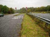
Bus lane for Washington Route for Stagecoach service 1 to Midhurst and Metrobus service 23 to Crawley.
Washington Roundabout - Geograph - 3486755.jpg
Washington Roundabout Opened in 1968 along with the village's bypass on the site of a former 19th century brickworks. In the foreground is the junction with Sandhill Lane which was the former road junction between the A24 and A283 heading west to Storrington. The long line of traffic trying to access the A24 has just left an event at Wiston House which happened over the bank holiday weekend.
A24, southbound - Geograph - 5566287.jpg
A24, southbound
Ashington Junction - Geograph - 3391122.jpg
Ashington Junction The Ashington By-Pass meets the B2133 and the main entrance and exit for the village. The by-pass was opened in 1994 to replace the old single carriageway that ran through the village.
Worthing Road - Geograph - 5130110.jpg
Worthing Road The current road junction with the A24 north of Dial Post. Over the centuries the routes have changed here, by 1724 a lane running north then eastwards to Rookcross Farm was the only route and followed the line of trees on the far side of the current dual carriageway. This lane became part of the 1802 Horsham-Worthing turnpike but was shortened in 1823 when a new route, heading north to the left, cut out the loop via Rookcross Lane by preceding straight to Bay Bridge. This became the A24 in the 20th century which became progressively busier and was turned into a dual carriageway north of this point in the mid 1960s. Another two decades of the hamlet of Dial Post being choked by traffic was ended in the late 1980s when the hamlet was bypassed reducing the former route to an access road.
Worthing Road - Geograph - 5047617.jpg
Worthing Road A view of the section between the entrance to the Knepp Estate and the junction with the B2135. The road is of some antiquity as the parish boundary between West Grinstead and Shipley follow it as far as the junction with Bar Lane to the north. The line here roughly follows the central reservation with the northbound lanes in the parish of Shipley and the southbound in that of West Grinstead. The road was widened here in the mid 1960s. Fairly quiet at 7am on a Saturday morning but has a reputation for having a high number of accidents due to the large number of minor junctions throughout its length.
Road Junction, The Bar - Geograph - 5077889.jpg
Road Junction, The Bar North of the Buckbarn Crossroads the two carriageways comprising the A24 north and south bound split into two sections. The junction with Bar Lane at The Bar requires those wishing to go north to cross the south bound lanes then continue a little to the west.
Roundabout on the A24 - Geograph - 2661953.jpg
Roundabout on the A24 One of five roundabouts that serve Horsham from its ring road.
Farthings Hill Interchange - Geograph - 237858.jpg
Farthings Hill Interchange Seen from the footbridge between Tanbridge School and the Broadbridge Heath Leisure Centre.
Warnham Road, Horsham - Geograph - 2709695.jpg
Warnham Road, Horsham
A24 approaching Great Daux Roundabout - Geograph - 4010698.jpg
A24 approaching Great Daux Roundabout
Station Road, Warnham - Geograph - 2709816.jpg
Station Road, Warnham
The Owl Kingsfold, not so clever now - Geograph - 3042969.jpg
The Owl Kingsfold, not so clever now Formerly called The Wise Old Owl.
Looking north on the A24 across the junction with the B2126 - Geograph - 5330487.jpg
Looking north on the A24 across the junction with the B2126
 
 
Page 1, 48 file(s) of 52 shown
Page 1 2

SABRE - The Society for All British and Irish Road Enthusiasts
Discuss - Digest - Discover - Help