Gallery:A256
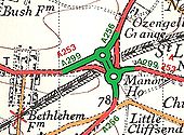
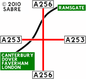
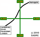
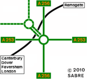
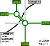
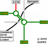
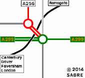
Scan showing the old and new road layout at the Lord of The Manor near Ramsgate. We lost a congested crossroads and gained a new rail bridge, two new roundabouts and two disused railway bridges. The old route of the A253 has been added for information.
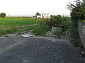
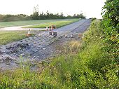
Originally uploaded to Coppermine on Jun 24, 2008 by YorklettsLooking south from the disused A256 at Lord of the Manor. The house in the distance is 'The Manor' itself. The crossroads where it met the A253 (now the A299) was just to the right of the house. Taken 16th June 2008. The modern A299 runs in front of the house to the new roundabouts which are just off to the right.
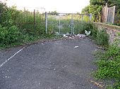
Originally uploaded to Coppermine on Jun 24, 2008 by YorklettsThe gate that now hinders any progress along the old A256 at Cliffsend. The old road beyond is sometimes used as a car park.
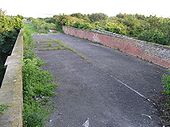
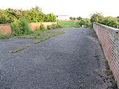
Originally uploaded to Coppermine on Jun 24, 2008 by YorklettsAnother view looking north across the old railway bridge that used to carry all traffic from Dover to Margate. Road markings are just visible as is the gate at the northern end. Taken 16th June 2008.
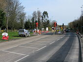
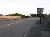
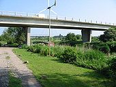
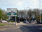
Originally uploaded to Coppermine on Jun 24, 2008 by YorklettsThe short A256/A299 multiplex at the Lord of the Manor Roundabout just outside Ramsgate. This view looking south across the railway bridge, built when the junction was redesigned in the early 1990's (I think). Left at the roundabout for Ramsgate and straight on for Sandwich. Taken 17th June 2008.
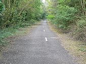
Originally uploaded to Coppermine on Jun 18, 2008 by YorklettsLooking north along the abandoned A256 just north of the old Lord of the Manor crossroads. This picture was taken from the north end of the abandoned railway bridge which is now gated. It looks as though the old road is being used for some kind of parking area. Whenever the circus comes to town it is based just to the right of this picture so I imagine that is when this area is used.
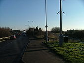
Originally uploaded to Coppermine on Jun 24, 2008 by YorklettsThis view is looking south towards the Lord of the Manor where the A256 used to meet the A253 just outside Ramsgate. The old crossroads were situated just to the right of the house in the distance. Taken 16th June 2008.
Originally uploaded to Coppermine on Jun 24, 2008 by YorklettsThe large roundabout joins the A2, A256, Sandwich Road, Honeywood Road.
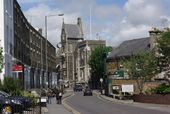
Looking along Priory Road from its junction with Norman Street. The distinctive building with the clock is the town hall.
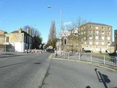
At its junction with Coombe Valley Road. Only the right hand carriageway of the road ahead was open to traffic as the left hand carriageway was cordoned off due to the laying of replacement sewer and gas mains. The converted mill building lies in Lorne Road.
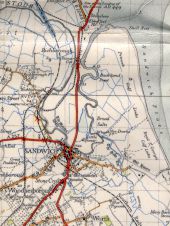
From OS 1' 6th series, mag var 1950, print code 1164. Originally uploaded to Coppermine on Jul 04, 2006 by FosseWay
This page contains scans from a map that is believed may be out of copyright according to UK Crown Copyright, UK Copyright Law for other maps published in the United Kingdom, or Irish Government Copyright, is not being used to generate profit in this context, and presents information that cannot be exhibited otherwise.If the copyright holder considers this is an infringement of their rights, please contact the site management team to discuss further steps.
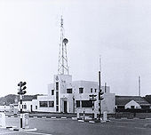
Located where a car park now stands. Built during the early 1930s and was on this site until at least the mid 1970s.
