Gallery:A283
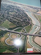
I went for a spin in my private plane from Shoreham Airport and took these pics. OK, this is a photo in Shoreham Airport foyer.
Originally uploaded to Coppermine on Feb 12, 2008 by SteveA30== Summary ==
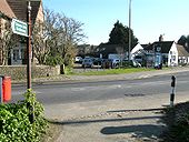
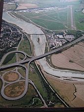
The point where the old A27 crossed the A283 at Shoreham, after crossing the River Adur.
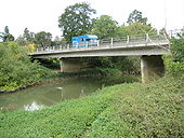
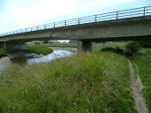
Originally uploaded to Coppermine on Feb 12, 2008 by SteveA30The new bridge replaced <a href='http://www.geograph.org.uk/photo/1502048'>TQ0218 : River Arun: Stopham Bridge</a> as the crossing of the A283 over the River Arun. The bridge was completed in 1986 and consists of four spans supported on reinforced concrete piers and abutments. Because of the poor ground conditions the piers are supported on piles that go down some 15 to 20 metres to the sandstone rock formation beneath the surface. A blue horsebox trundles across the bridge heading in the direction of Pulborough.
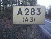
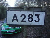
Most rural A roads in Surrey kept their old signs, this is as soon as you cross the border from Sussex.
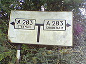
Originally uploaded to Coppermine on Mar 02, 2009 by DavidNW9Without actually telling you where you are going (Milford), this is a copy of the one a few miles south. It seems towns need a minimum population before being mentioned on the A road signs.
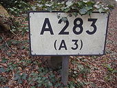
Originally uploaded to Coppermine on Mar 02, 2009 by DavidNW9Heading south to Sussex this sign is on the back of the northbound one.
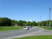
Originally uploaded to Coppermine on Mar 02, 2009 by DavidNW9This sign is on an unclassified road approaching a road that used to be the A283. The sign still has the glass beads on the letters and arrows.
Originally uploaded to Coppermine on Dec 08, 2006 by LewisThis is how the route of Radial 10 (London - Portsmouth) from the 1944 map (on CBRD) wouls have run, applied to modern 1:50k. Note how envirnmentally instnsitive this route was, in addition to an engineering nighmare. Originally uploaded to Coppermine on Dec 03, 2005 by M4 Cardiff
This page includes a scan of a non-free copyrighted map, and the copyright for it is most likely held by the company or person that produced the map. It is believed that the use of a limited number of web-resolution scans qualifies as fair use under United States copyright law, where this web page is hosted, as such display does not significantly impede the right of the copyright holder to sell the copyrighted material, is not being used to generate profit in this context, and presents information that cannot be exhibited otherwise.
If the copyright holder considers this is an infringement of their rights, please contact the Site Management Team to discuss further steps.
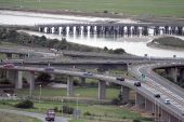
These were very large photos in the foyer of Shoreham Airport terminal. The old A27 can be clearly seen. It rejoins the newer road at those rather annoying traffic lights that ruin the otherwise freeflow section.
Originally uploaded to Coppermine on Feb 12, 2008 by SteveA30