Gallery:A4086
From Roader's Digest: The SABRE Wiki
Jump to navigation
Jump to search
A4000-A4099 > A4086
This gallery has no child categories
A4086
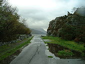
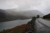
Llyn Padarn
The now-disused (and eroding) former A4086, right at the edge of Llyn Padarn, Llanberis.
Taken in 2005, and making its appearance as my first ever PoTM entry!
Originally uploaded to Coppermine on May 21, 2008 by sgill77The Cwm-y-glo by-pass
This by-pass was constructed just prior to the start on the Dinorwig HEP scheme to ease access to Llanberis.
This by-pass was constructed just prior to the start on the Dinorwig HEP scheme to ease access to Llanberis.
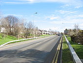
Tanrallt aka Stryd Mari
This road outwards from the centre of the town links with the Bethel and Llanberis roads.
This road outwards from the centre of the town links with the Bethel and Llanberis roads.
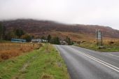
A Disused Filling Station with Elidir Fawr in the distance
A view of the road junction between Pont Rhythallt and Llanrug, with a disused filling station in the foreground. More and more rural filling stations are closing as the super-markets greedily swallow all the business, yet there appear to be more cars on the roads, how far will drivers go to save a couple of pence on a gallon, probably making their journey uneconomical!
A view of the road junction between Pont Rhythallt and Llanrug, with a disused filling station in the foreground. More and more rural filling stations are closing as the super-markets greedily swallow all the business, yet there appear to be more cars on the roads, how far will drivers go to save a couple of pence on a gallon, probably making their journey uneconomical!
A fast section of the A4096 approaching the A4547 Bangor road
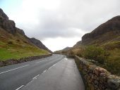
This section of the Llanberis to Caernarfon road, constructed at the same time as the Dinorwig HEP scheme, follows the line of the old LMS railway. It avoids the bad bends which characterised the old road at Penllyn.
This section of the Llanberis to Caernarfon road, constructed at the same time as the Dinorwig HEP scheme, follows the line of the old LMS railway. It avoids the bad bends which characterised the old road at Penllyn.
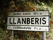
Pre Worboys sign at the entry point of Llanberis
A nice old sign amid the fuchsias in Snowdonia. Notice the old-style spelling 'CAERNARVON'.
Originally uploaded to Coppermine on Feb 02, 2006 by Richard WalkerHidden categories:
