Gallery:A464
From Roader's Digest: The SABRE Wiki
Jump to navigation
Jump to search
A400-A499 > A464
This gallery has no child categories
A464
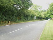
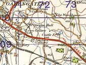
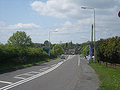
Now-defunct A464 route through Priorslee, Telford
This page contains scans from a map that is believed may be out of copyright according to UK Crown Copyright, UK Copyright Law for other maps published in the United Kingdom, or Irish Government Copyright, is not being used to generate profit in this context, and presents information that cannot be exhibited otherwise.
If the copyright holder considers this is an infringement of their rights, please contact the site management team to discuss further steps.
If the copyright holder considers this is an infringement of their rights, please contact the site management team to discuss further steps.
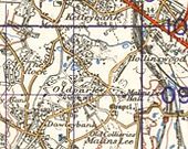
Telford town centre in 1949
This page contains scans from a map that is believed may be out of copyright according to UK Crown Copyright, UK Copyright Law for other maps published in the United Kingdom, or Irish Government Copyright, is not being used to generate profit in this context, and presents information that cannot be exhibited otherwise.
If the copyright holder considers this is an infringement of their rights, please contact the site management team to discuss further steps.
If the copyright holder considers this is an infringement of their rights, please contact the site management team to discuss further steps.
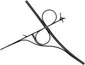
Layout of Castle Farm Interchange, then known as Knowlsbank Interchange, as approved in 1973. This layout was to allow freeflow access between the M54 and the new town of Telford. Plans for Telford were soon scaled back so the design was changed to the junction that was eventually built along with the name.
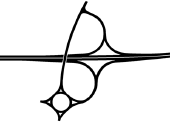
Initial proposal for Castle Farm Interchange, then called Knowlbank Interchange, from 1970. This was replaced a year later with an improved layout.
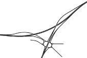
Plan of the unbuilt Blythbury Interchange in Telford
Layout of Knowlbank Interchange for the M54 northern route.
Hidden categories:
