Gallery:A555

From Roader's Digest: The SABRE Wiki
Jump to navigation Jump to search
A500-A599 > A555


This gallery has no child categories
A555
 
 
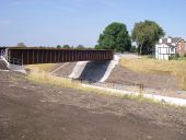
New Dairy House Farm - Geograph - 116025.jpg
New Dairy House Farm
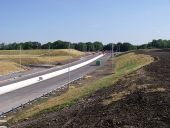
SEMMMS A555 Scheme 6 - Coppermine - 829.jpg
SEMMMS A555 Scheme 6

Macclesfield Road Junction (current A523)

OP RickyB_UK

Originally uploaded to Coppermine on Apr 16, 2005 by M4Simon
A555 or M555 Manchester - Coppermine - 942.jpg
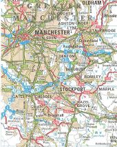
A555 or M555? Manchester

The Manchester A555 was it ever planned as a motorway? Perhaps to connect to the projected A6(M) Stockport north / south bypass? Well this scan from a 1988 'Reader's Digest' Road Atlas has the tell tale blue dashed line to say 'projected motorway'.

OP jim

Originally uploaded to Coppermine on Apr 17, 2005 by M4Simon

This page includes a scan of a non-free copyrighted map, and the copyright for it is most likely held by the company or person that produced the map. It is believed that the use of a limited number of web-resolution scans qualifies as fair use under United States copyright law, where this web page is hosted, as such display does not significantly impede the right of the copyright holder to sell the copyrighted material, is not being used to generate profit in this context, and presents information that cannot be exhibited otherwise.
If the copyright holder considers this is an infringement of their rights, please contact the Site Management Team to discuss further steps.

SEMMMS A555 Scheme 4 - Coppermine - 827.jpg
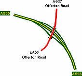
SEMMMS A555 Scheme 4

A627 Offerton Road Junction

OP RickyB_UK

Originally uploaded to Coppermine on Apr 16, 2005 by M4Simon
SEMMMS A555 Scheme 2 - Coppermine - 825.jpg
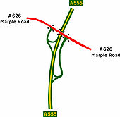
SEMMMS A555 Scheme 2

A626 Marple Road Junction

OP RickyB_UK

Originally uploaded to Coppermine on Apr 16, 2005 by M4Simon
SEMMMS A555 Scheme 3 - Coppermine - 826.jpg
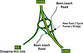
SEMMMS A555 Scheme 3

A6 Stepping Hill Link junction

OP RickyB_UK

Originally uploaded to Coppermine on Apr 16, 2005 by M4Simon
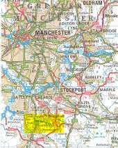
A555 projected as a motorway - Coppermine - 15055.jpg
A555 projected as a motorway? Originally uploaded to Coppermine on Sep 02, 2007 by Jim606
Manchester Airport Eastern Link Road - Geograph - 2573870.jpg
Manchester Airport Eastern Link Road
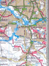
Unknown motorway south of Cheadle - Coppermine - 14901.jpg
Unknown motorway south of Cheadle

From the Reader's Digest Atlas of the British Isles, 1988 reprinted with amendments 1993. Originally uploaded to Coppermine on Aug 22, 2007 by FosseWay

This page includes a scan of a non-free copyrighted map, and the copyright for it is most likely held by the company or person that produced the map. It is believed that the use of a limited number of web-resolution scans qualifies as fair use under United States copyright law, where this web page is hosted, as such display does not significantly impede the right of the copyright holder to sell the copyrighted material, is not being used to generate profit in this context, and presents information that cannot be exhibited otherwise.
If the copyright holder considers this is an infringement of their rights, please contact the Site Management Team to discuss further steps.

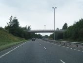
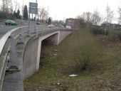
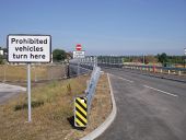
This should be a dual carriageway! - Flickr - 8377060614.jpg
On the B5358 - formerly the A34. This should be the A555 heading out towards Poynton, the A523, Hazel Grove and the A6. If you have sharp eyesight, you might be able to see a green road sign among the greenery - this is where the eastbound sliproad from the B5358 joins the imaginary mainline of the A555.
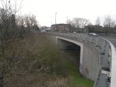
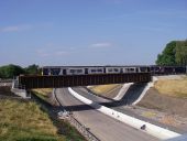
Bridge over nothing - Flickr - 8377061108.jpg
This bridge carries the ex-A34 over the non-existent A555 which takes imaginary traffic between the A6 and Manchester Airport, Confused? You should be!
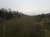
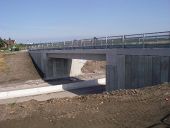
Unused A555 bridge.jpg
Well nothing underneath, at least. This should be the A555 but it isn't!
DSC 0442 2016-12-03 Woodford Road A555.JPG
The Wilmslow Road, near the Lakeland shop, has for many years run across an orphan bridge.

The bridge stood for more than 15 years above an increasing jungle; all of this was swept away in 2016. On December 3rd 2016, the bridge now stands above the base levels of the new (westward) extension of the Manchester Airport A555 Eastern approach road as it marches towards Styal Road and the airfield.

Roll on summer 2017!

Mike Hindson-Evans
DSC 0543 Shadowmoss Runway 1 threshold 2016-12-03.JPG
Looking East. In a year, the Manchester Airport Approach road should merge into this road from the right, through the yellow pillars which support the airfield approach lights.

The new A555 road alignment has to "thread the needle" over Styal Road, crossing the railway line to the south and then the railway line into the airport (which lies in a cutting just behind the wire fence to the right of this road).

This scene has already changed in recent years, with the Metrolink (tram) line, visible on the left of the picture, now running past the photographer's left shoulder and then under this road into the Airport Transport interchange.

  • this is the 'before' half of a 'before & after' set which I expect to update in December 2017. Mike
DSC 0490 2016-12-03 Woodford Road A555.JPG
The bridge, which was built long ago, now has the structure of a road being built beneath it.
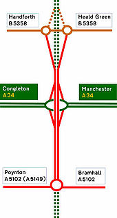
A555 Manchester Airport Link Road Strip Map - Coppermine - 846.jpg
A555 Manchester Airport Link Road Strip Map

Current Extent of the A555 Manchester Airport Link Road. Proposed sections are shown as dashed

OP RickyB_UK

Originally uploaded to Coppermine on Apr 16, 2005 by M4Simon
20180714-0829 - Buxton Road Bus Bridge over new A555 - 53.367986N 2.101013W.jpg
Buxton Road Bus Bridge over new A555
20180714-0829 - Railway bridge over A555 - 53.367986N 2.101013W.jpg
Railway bridge over A555
20180714-0830 - A555 meeting the realigned A6 junction at Simpsons Corner - 53.368261 2.101115W.jpg
A555 meeting the realigned A6 junction at Simpsons Corner
20180714-0831 - A555 looking west at railway bridge - 53.368261 2.101115W.jpg
A555 looking west at railway bridge
20180714-0831 - Old A6 - new bus bridge over A555 - 53.368101N 2.100519W.jpg
Old A6 - new bus bridge over A555
20181220-1217 - A555 Manchester Airport Eastern Link Road from Woodford Road overbridge, looking west 53.356039N 2.139033W.jpg
A555 Manchester Airport Eastern Link Road from Woodford Road overbridge, looking west
20181220-1215 - A555 Manchester Airport Eastern Link Road from Woodford Road overbridge, looking east 53.356013N 2.138722W.jpg
A555 Manchester Airport Eastern Link Road from Woodford Road overbridge, looking east
20181220-1215 - A555 Manchester Airport Eastern Link Road Woodford Road overbridge, looking north 53.356013N 2.138720W.jpg
A555 Manchester Airport Eastern Link Road Woodford Road overbridge, looking north
20181220-1211 - A555 Chester Road Junction looking east 53.350967N 2.154998W.jpg
A555 Chester Road Junction looking east
20181220-1157 - A555 Styal Road Junction looking SouthWest 53.362256N 2.243071W.jpg
A555 Styal Road Junction looking SouthWest
20181220-1159 - A555 accommodation bridge, heading east 53.356954N 2.232642W.jpg
A555 accommodation bridge, heading east
20181220-1154 - view from Ringway road to A555 Ringway Road West 53.365035N 2.252641W looking west.jpg
view from Ringway road to A555 Ringway Road West
20181220-1203 - Woodford Road Junction 53.350102N -2.167153W.jpg
Woodford Road Junction
20181220-1205 - View West of A555 from Woodford Road Junction 53.350102N 2.164965W.jpg
View West of A555 from Woodford Road Junction
20181220-1203 - Woodford Road Junction 1 - 53.350064N 2.164557W.jpg
Woodford Road Junction
 

SABRE - The Society for All British and Irish Road Enthusiasts
Discuss - Digest - Discover - Help