Gallery:A74(M)
Summary[edit source]
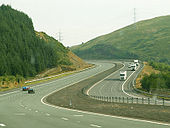
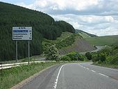
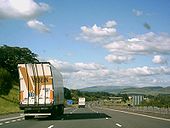
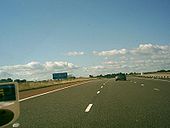
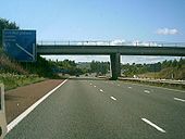
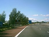
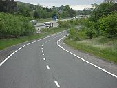
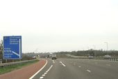
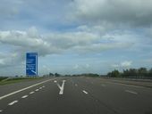
Shot heading south down the A74(M) between Abington and Moffat.
Winner - November 2005
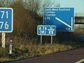
Originally uploaded to Coppermine on Oct 21, 2005 by achmelvicJust short of the Scottish border, too. Taken on the 6 December 2008 roadtrip.
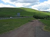
Originally uploaded to Coppermine on Dec 09, 2008 by nowsterJust north of Crawford, original alignment straight ahead, 1960s (where the silver Porsche is) to the left, and 1990s A74(M) further left
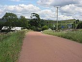
Originally uploaded to Coppermine on Jun 16, 2008 by leopard680Just to the north of Crawford, this old alignment remains in use as access to a farm and a BT building. 1960s alignment to the right and 1990s A74(M) to the right of that. Quite a lot of the 1920s/30s A74 seems to have been surfaced in this red tar surface. Perhaps a local stone but does anyone know if there was a more practical reason for this?
Originally uploaded to Coppermine on Jun 16, 2008 by leopard680It's amazing to think that four lanes squeezed over this bridge. There couldn't have been much of a central reservation. Last time I passed over it trucks had taken to parking on the verges, but they've put cones out as you can see to prevent this.
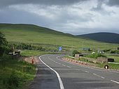
Originally uploaded to Coppermine on Jun 16, 2008 by leopard680At the beginning of the drop down to Nether Howcleugh. 1990s A74(M) to the left. This is at the top end of the old separate north & southbound carriageways, which were somedistance apart between here and the railway bridge.
Originally uploaded to Coppermine on Jun 16, 2008 by leopard680Whereas now the road exits Ecclefechan curving under the existing A74(M).
Originally uploaded to Coppermine on Jun 15, 2008 by leopard680A lovely evening at Johnstonebridge, looking south. you can see the A74(M), and just to the left of it the old alignment of the A74 - it crosses over the A74(M) just south of here.
Originally uploaded to Coppermine on Jun 10, 2008 by leopard680Here is the A74 as it was in 2007.
Originally uploaded to Coppermine on Oct 04, 2005 by ABeatonAlthough the picture is distorted, this show the A74(M) & the hills in good stead. The Borders are very nice however not many Dual Carrageways. Very much Mitsubishi Evo IX territory the Border area.
Originally uploaded to Coppermine on Sep 20, 2005 by ABeatonHere is the A74 after the D3M started. This section was rebuilt in the early 1990's as part of the first phase of the A74 Upgrade. Once the HA finally start on the cumberland gap & it completion sometime in 2008/10, this section would have been waiting for the motorway to come to it section for 17-19 years. The Leech Line upgrade isn't as bad as it has taken the same time to upgrade 450 miles of railway & the Cumberland gap is only 6 miles. As Pathetic as the A6144(M)
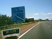
Originally uploaded to Coppermine on Sep 20, 2005 by ABeatonHere is J16 of the A74(M). After this Juction is the newest section of the motorway, built in 1999. Some of the sign around the juctions still say Glasgow, Edinburgh A74 depite the fact the A74 here has been gone from this area since 1999. Still it is a much better road now. Especially if you are coming from the South East, the Motorway has cut off about 30 mins from the journey as there are three lanes & no buses & right turns.
Originally uploaded to Coppermine on Sep 20, 2005 by ABeatonAfter crossing the Scottish Border, we see the first motorway fork sign in Scotland. All traffic for Gretna & Gretna Green having gone off at the A6071 junction.
Originally uploaded to Coppermine on Sep 19, 2005 by ABeatonThis is the last Motorway fork sign in England on the West Coast. The Next one is in Scotland. It is for the A75
Originally uploaded to Coppermine on Sep 19, 2005 by ABeatonHere is the sign for the Scottish Border on the A74(M) at Grenta. The 'country' sign is after this border sign. This was the first section to be upgraded back in the early 1990's
Originally uploaded to Coppermine on Sep 18, 2005 by ABeatonThe A74 is long dead. its been dead for 40 years. Now in 2058, the M6 has been extented towards Edinburgh. 100 years after the Preston By-Pass Opened, the M6 is now a 370 mile Motorway. The extended secton of M6 runs though the border Region. The section Formerly known as the A74(M) has now been opened for 59 Years, 49 of which has been known as M6. The first M74 extention has been open for 70 years, the original section nearing 100 though D3M by now & the Glasgow section for 63 & 50 years repectly.
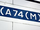
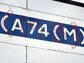
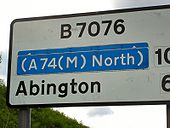
Originally uploaded to Coppermine on Jul 25, 2005 by ABeatonThis direction sign on the B7076 appears to have something underneath (A74(M))
Originally uploaded to Coppermine on Jul 08, 2005 by A68NickThe close up of the patching shows that (M6) can be easily seen underneath (A74(M)).
Originally uploaded to Coppermine on Jul 08, 2005 by A68NickThe outline of (M6) underneath (A74(M)) has been picked out in red.
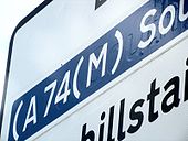
Originally uploaded to Coppermine on Jul 08, 2005 by A68NickA mileage sign on the B7076 with the west coast mainline and the A74(M) in the background. As can be seen the (A74(M) South) has clearly been stuck over something else.
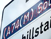
Originally uploaded to Coppermine on Jul 08, 2005 by A68NickThe outline of (M6 South) can be made out underneath (A74(M) South)
Originally uploaded to Coppermine on Jul 08, 2005 by A68NickThis photo has the outline of the (M6 South) that can be seen underneath (A74(M) South) highlighted in red.
Originally uploaded to Coppermine on Jul 08, 2005 by A68NickNot much effort's been made here to disguise the true identity of the A74(M)!
Originally uploaded to Coppermine on Jul 08, 2005 by A68NickThe A74 is dead. RIP 1923-2008. It now known as the M6. The M6 is bigger, longer & just as busy as ever. The Cumberland Gap has closed and the B7076 has been extended to the A7 thus taking over the last section of the A74, the Scottish section being renumbered A721. The Scottish Motorway Network (West) is now connected at last to the English Motorway network thus the British Motorway network is whole at last 52 years after the M6 first opened by-passing Preston.
Originally uploaded to Coppermine on Jun 17, 2005 by ABeatonhere is the M6 at Lockerbie. The main changes here is the M6 number & new junction numbers as it is now part of the M6.
Originally uploaded to Coppermine on Jun 17, 2005 by ABeatonThe A74(M) is as dead as the A74. The M6 ate it for Breakfast. Yum yum! Anyway, the M6 is at Annandale Services & J53 (nee J16). This was where the last part of the main Scottish M74 upgrade happened.
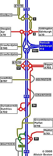
Originally uploaded to Coppermine on Jun 17, 2005 by ABeatonWhere the A74(M)/M74 changeover happen is now the M6/M74 Change over. The M6 has been extended over the old A74(M). The M6 now has 56 non Suffixed Junctions. J55 nee J14 remains a streched Juction. M74 J13 is now J1. All Juctions of the M74 now start here. The M6 ends here as it just might be extended towards Edinburgh.
Originally uploaded to Coppermine on Jun 17, 2005 by ABeatonHere is the A74 in the Glory years of 1976-85. This is the third section, Lockerbie-A701.
Originally uploaded to Coppermine on Jun 16, 2005 by ABeatonThe only major change to the A74 at this end of the road is the upgrade of Gretna local Services to full MSA. The Bridges are built as D3M ready for the upgraded road.
Originally uploaded to Coppermine on May 21, 2005 by ABeatonThe first phase of the A74 upgrade has begun on the Gretna Green By-Pass. Work has also begun to GSJ the A75 & the Gretna roundabout to a half diamond.
Originally uploaded to Coppermine on May 21, 2005 by ABeatonThe slow death of the A74 has begun. The A74(M) is now built over the old Gretna Green By-Pass. It is D3M.
Originally uploaded to Coppermine on May 21, 2005 by ABeatonHere is the A74 in the Glory years of 1976-85. This is the Second section, North of Gretna Green, Lockerbie.
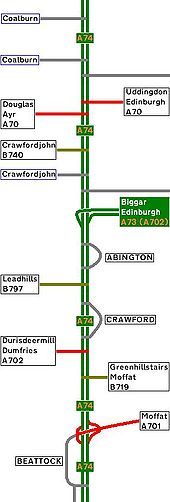
Originally uploaded to Coppermine on May 12, 2005 by ABeatonHere is the A74 in the Glory years of 1976-85. This is the forth section, A701-Coalburn.
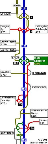
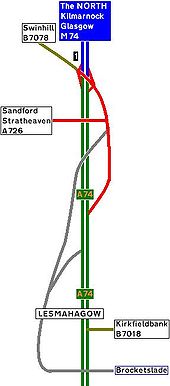
Originally uploaded to Coppermine on May 12, 2005 by ABeatonHere is the A74 in the Glory years of 1976-85. This is the fifth section, Coalburn-M74 J1.
Originally uploaded to Coppermine on May 12, 2005 by ABeatonMore of the same, approaching a steep descent.
Originally uploaded to Coppermine on Jan 21, 2006 by rsorionboyLooking north, just south of Abington the southbound carriageway of the new A74M was built partially over the top of the northbound carriageway of the old A74. This is the old southbound
Originally uploaded to Coppermine on Jul 02, 2007 by leopard680
