Gallery:Ayr
From Roader's Digest: The SABRE Wiki
Jump to navigation
Jump to search
Places in Scotland > Ayr
This gallery has no child categories
Ayr
A79
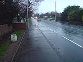
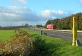
Heading into Ayr on Maybole Road.
Originally uploaded to Coppermine on Mar 03, 2009 by bobklakerA79
Entering Ayr on Maybole Road just off A77.
Originally uploaded to Coppermine on Mar 03, 2009 by bobklakerA79
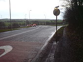
The southern end of the A79 where it leaves Ayr and meets the A77.
Originally uploaded to Coppermine on Mar 03, 2009 by bobklakerWestern end of A70
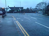
This is where the A70 ends and meets the A719 in Ayr.
Originally uploaded to Coppermine on Jan 29, 2009 by bobklakerAfter The Flood
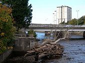
Debris by the River Ayr at the Mill Brae car park after the previous week's flood. Victoria Bridge, in this square, is in the background.
Debris by the River Ayr at the Mill Brae car park after the previous week's flood. Victoria Bridge, in this square, is in the background.
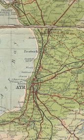
Ayr 1929
Shows the original route of A77, most of which is now the A79, going through Monkton(junction with A78), Prestwick and Ayr.
Originally uploaded to Coppermine on Feb 21, 2009 by bobklakerB747 Craigie Road, Ayr (C) wfmillar
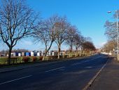
Horse transporters parked up on football ground. This road passes the western end of the racecourse.
Horse transporters parked up on football ground. This road passes the western end of the racecourse.
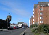
Harbour Street, Ayr (C) Mary and Angus Hogg
Looking towards the sea on a bright March day. The flats on the right are built on the old fish market site. The tower on the left is Miller's Folly, an addition to the old Cromwellian citadel walls. For more information, see <a href='http://www.geograph.org.uk/photo/1195215'>NS3322 : Miller's Folly At Ayr Harbour</a>.
Looking towards the sea on a bright March day. The flats on the right are built on the old fish market site. The tower on the left is Miller's Folly, an addition to the old Cromwellian citadel walls. For more information, see <a href='http://www.geograph.org.uk/photo/1195215'>NS3322 : Miller's Folly At Ayr Harbour</a>.
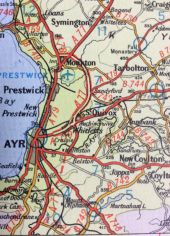
Taken from a 1965 road atlas, showing the Ayr bypass under construction with the northern section already completed.
Hidden categories:
