Gallery:B2089
From Roader's Digest: The SABRE Wiki
Jump to navigation
Jump to search
B2000-B2099 > B2089
This gallery has no child categories
B2089
B2244 Cripp's Corner
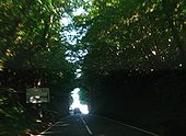
B2244, the former A229, approaching the vintage GSJ at Cripp's Corner from the north. Although it followed a Roman road between Hawkhurst and Sedlescombe the A229 was rerouted to join the A21 further north at Hurst Green due to a number of pinch points on an otherwise fairly fast alignment. The narrow overbridge, carrying the B2089, at Cripp's Corner is one of them. Taken 4th June 2008.
Originally uploaded to Coppermine on Jun 09, 2008 by YorklettsHastings area
If the copyright holder considers this is an infringement of their rights, please contact the site management team to discuss further steps.
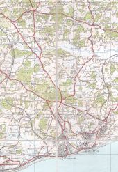
OS Popular (4th) edition sheet 135, 1935. This shows two early GSJs on the (then) A21 -- at Cripp's Corner and Baldslow. Originally uploaded to Coppermine on Aug 31, 2006 by FosseWay
This page contains scans from a map that is believed may be out of copyright according to UK Crown Copyright, UK Copyright Law for other maps published in the United Kingdom, or Irish Government Copyright, is not being used to generate profit in this context, and presents information that cannot be exhibited otherwise.If the copyright holder considers this is an infringement of their rights, please contact the site management team to discuss further steps.
Hidden categories:
