Gallery:B2 (Northern Ireland)
From Roader's Digest: The SABRE Wiki
Jump to navigation
Jump to search
B1-B99 (Northern Ireland) > B2 (Northern Ireland)
This gallery has no child categories
B2 (Northern Ireland)
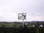
Sign at Edenballycoggill
It is a much sharper bend than the one depicted on this ageing sign.
It is a much sharper bend than the one depicted on this ageing sign.
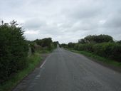
The B2 between Derryadd and Derrytrasna
The B2 ends just after Charlestown (Bannfoot) as there is no bridge across the river Bann. The road continues on the other side, though.
The B2 ends just after Charlestown (Bannfoot) as there is no bridge across the river Bann. The road continues on the other side, though.
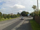
Belfast Road, Ballymacateer
This is the A3 Belfast Road - in the short semi-rural patch that separates Lurgan and Dollingstown - in the townland of Ballymacateer. The B2 Dromore Road junction can be seen on the right. The view is towards Dollingstown village.
This is the A3 Belfast Road - in the short semi-rural patch that separates Lurgan and Dollingstown - in the townland of Ballymacateer. The B2 Dromore Road junction can be seen on the right. The view is towards Dollingstown village.
The Crossgar Road, Ballynahinch (3) Part of the road, just past the Drumaghlis Road, before it starts its undulating course towards Ballynahinch. [The Crossgar Road, Ballynahinch (4)] shows the road ascending the hill in the background.
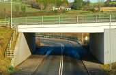
Underpass, Dromore The underpass at the Belfast end of the bypass was completed in 2005. In this view traffic heading from the Hillsborough Road towards Belfast, descends by a 1in10 gradient before reaching the bypass via a tight, speed-restricted, bend.
