Gallery:B4514
From Roader's Digest: The SABRE Wiki
Jump to navigation
Jump to search
B4500-B4599 > B4514
This gallery has no child categories
B4514
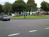
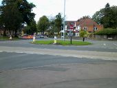
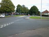
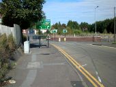
The junction between the A4040 and B4514, as seen from the north looking south-east. The B4514 eastbound is in the far right of the picture; the A4040 southbound is in the far left. Behind the camera to the right is a stretch of road that's inconsistently signed as the B4514 and as a spur of the B4217, providing the missing movements for the junction between the B4146, B4217, and A4040.
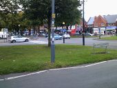
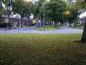
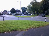
The junction between the B4514 and A4040, as seen from the unclassified carriageway of Olton Boulevard East (the B4514, seen in the centre left of the diagram, is the other carriageway of the same road), looking west. According to some signs, the B4514 continues across the roundabout opposite; according to others, the opposite road is a spur of the B4127. (This road is not visible in this picture.)
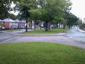
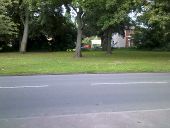
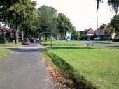
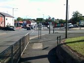
A photo of the west end of Olton Boulevard East, looking west. The south carriageway (on the left of the picture) is the B4514; the north carriageway (on the right of the picture) is unclassified. The A4040 is barely visible in the distance; the B4217 is technically in view, but so far away that only a few pixels on the image depict it.
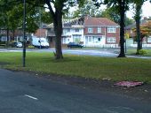
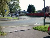
The B4514's unusual layout means that it has constant reminder signs telling traffic that both carriageways have two-way traffic. Visible here are both vertical (on the right) and horizontal (on the left) warnings that traffic flows both ways, on the B4514 itself. (The picture was taken from the other carriageway of Olton Boulevard East, which has horizontal but not vertical two-way traffic warnings.)
The roundabout between the B4514 and Shirley Road, looking east. This is the westmost point on which the two parallel carriageways that make up the road have different names (Victoria Road on the left, the B4514 Olton Boulevard East on the right). The photograph was taken from the centre of the roundabout, at an angle that makes the nature of the road system as two carriageways + central reservation clear.
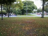
The B4514 is part of a road system that consists of two parallel carriageways along its length. Victoria Road, the parallel carriageway in the central section of the road, is mostly hidden from view via careful placement of trees, but this picture shows that it is barely visible if you know where to look.
The junction between the B4514 (running left to right in this diagram) and Botteville Road (which was closed further up when the photo was taken; the signed diversion here goes along Victoria Road). Due to the unusual nature of the B4514, it's very hard to describe the junction, even though it looks really familiar; it's not a roundabout because the priorities are wrong, and it's not a longabout because the B4514 is not a dual carriageway. The 'No entry' sign here is probably necessary, despite the junction layout, because this road disobeys so many conventions that drivers would be unsure what to think.
A junction between the B4514 and Dolphin Lane. This continues the B4514's tradition of being confusing for drivers, although in a different way from its usual style about confusion about which way roads run. It's a staggered junction (Dolphin Lane entering from the bottom right, and continuing to the top left), except it's also a crossroads (the road in the top right continues opposite Dolphin Lane, but is Wildfell Road), making this a variant of the TOTSO. Additionally, it looks a lot like there's a splitter island on the right, but there isn't; in the centre right of the diagram is actually a cul-de-sac spur of Dolphin Lane. The 'other carriageway' of the B4514 is barely visible in the centre left, and has been converted into a driveway.
The A41 forms a sort of gyratory system with the B4514 in which the northbound carriageway separates, TOTSOs right at the B4514, then meets the southbound carriageway at a T-junction. Thus, the left-hand lane to turn left is the normal route to continue forwards along the road (making this a staggered junction TOTSO). The right-hand lane effectively does a U-turn, which is necessary because traffic joining from the B4514 is only allowed to proceed northbound along the A41.
The U-turn lane allowing southbound traffic on the A41 to join the northbound carriageway, at which point it can join the B4514, forming one corner of a gyratory. The southbound carriageway comes from the bottom-left of the picture and leaves at the top (or can U-turn towards the other carriageway); the north-bound carriagway comes from the top of the picture and leaves at the right. An unclassified road also joins from the left of the picture, making the layout even more confusing (it took me several minutes to figure out how to cross the road from here and then find a safe gap in the traffic to do so).
Hidden categories:
