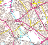
Gallery:Black Country Spine Road
The Lunt is an interesting design. I had assumed the existing junction would have been GSJ'd by utilising the flaring for a flyover. I had never envisaged anything more elaborate was planned, especially something fully freeflowing. The freeflowing nature is somewhat spoilt by the roundabout immediately to the west but everything west of there is at-grade anyway and was planned that way as soon as the earlier motorway scheme was cancelled.
Another interesting junction is the northern of the two roundabouts at Wednesbury. There is an underpass beneath the roundabout for traffic from the A461 to the local road serving the local businesses. This makes it a three level junction.
Although not part of the Spine Road, the junctions on the A454 immediately west of M6 J10 are shown differently on late 1980's plans to what was eventually built. Two westbound offslips in quick succession are shown with no eastbound equivalents - the B4464 catering for eastbound movements. The offslip nearest the M6 was built but the second one was replaced with a full access roundabout GSJ which is arguably much better as it takes traffic off the B4464 and other local roads.
Finally, I have altered the road numbering from what currently exists. A41 now continues northwards to The Lunt. A41 west of Moxley becomes a continuation of the A4038. A41 between Wednesbury and Moxley now downgraded in its entirety. Until I know otherwise, this is purely speculation on my part but makes perfect sense had the original route been built.Taken from OS Landranger sheet 139 (Birmingham and Wolverhampton), revision B2; published July 1994.
This page includes a scan of a non-free copyrighted map, and the copyright for it is most likely held by the company or person that produced the map. It is believed that the use of a limited number of web-resolution scans qualifies as fair use under United States copyright law, where this web page is hosted, as such display does not significantly impede the right of the copyright holder to sell the copyrighted material, is not being used to generate profit in this context, and presents information that cannot be exhibited otherwise.
If the copyright holder considers this is an infringement of their rights, please contact the Site Management Team to discuss further steps.
