Gallery:C67 (Cambridgeshire)

From Roader's Digest: The SABRE Wiki
Jump to navigation Jump to search
Class III Roads (Cambridgeshire) > C67 (Cambridgeshire)


This gallery has no child categories
C67 (Cambridgeshire)
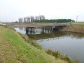
 
 
Chapel Bridge crossing Bevills Leam - Geograph - 3227662.jpg
Chapel Bridge crossing Bevill's Leam South of Whittlesey at the end of Turningtree Road. The drain is known as The Twenty Foot Drain further to the east.
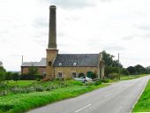
Pumping Station - Geograph - 1559931.jpg
Pumping Station Old Pumping Station on Glassmoor Bank.
 

SABRE - The Society for All British and Irish Road Enthusiasts
Discuss - Digest - Discover - Help