Dorset In 1962
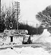
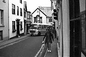
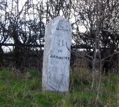
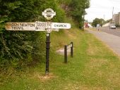
Photo taken between Boxing day and New Years Eve 1962 near Maiden Newton, Dorset.
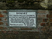
Originally uploaded to Coppermine on Sep 26, 2007 by AAndy Deportation For Vandals
On a bridge- see 'Deportation For Vandals Junction'
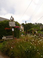
Originally uploaded to Coppermine on Feb 27, 2009 by AAndy Morcombelake: old No Through Road sign
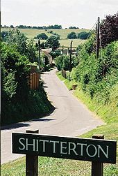
Shitterton
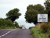
A little hamlet near Bere Regis, this is looking along the approach road from what used to be the A35 before the Bere Regis bypass was built.
The sign is one of the most stolen ever!
Originally uploaded to Coppermine on Mar 29, 2008 by TS
This has been replaced with an engraved stone sign - C2r December 2015
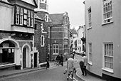
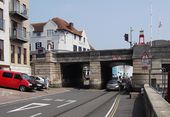
A3052 Narrow Section- Lyme Regis
Looking towards the centre from the east, hooded lights on right. 1971.
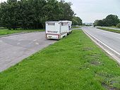
Originally uploaded to Coppermine on Sep 28, 2007 by AAndy Old A30
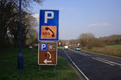
Looking east, back along the old road, to a picnic area built on the site.
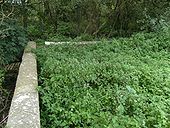
Originally uploaded to Coppermine on Nov 15, 2008 by SteveA30 Overgrown A30, Sept 2008
Old approach to a river bridge near Shaftesbury, Dorset.
Originally uploaded to Coppermine on Nov 15, 2008 by SteveA30 No entry sign
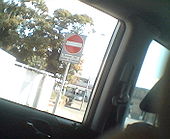
No entry except buses and cycles coming off the A35 Fernside Road in Poole.
Originally uploaded to Coppermine on Sep 17, 2007 by A3049 Toller Down Gate, Dorset
Approaching the A356 from the B3163 . At 810', its one of the highest points on a public rd in Dorset, turn left on the A356 and 1 miles along near the communications place its 822'.
Originally uploaded to Coppermine on Feb 27, 2009 by AAndy Traffic Light Section A3052 - 1971
Looking West, Lyme Regis. Traffic lights on Left past Museum entrance
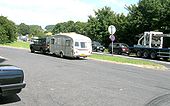
Originally uploaded to Coppermine on Sep 28, 2007 by AAndy A30
The picnic area nearer the newer road, looking west towards the modern bridge. realigned circa 1966.
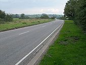
Originally uploaded to Coppermine on Nov 15, 2008 by SteveA30 A30
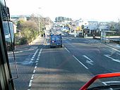
The always quiet non-trunk A30. Looking east towards Shaftesbury.
Originally uploaded to Coppermine on Nov 15, 2008 by SteveA30 A35 queue Aug 08
The westbound crawl near Dorchester. The sign is a No Right Turn, although, as there are toilets here, many ignore it. Hold-ups also on the M5, A30, A303 and A66, partly due to accidents.
Originally uploaded to Coppermine on Jul 26, 2008 by SteveA30 A3040
Feb 13 2008. Another coach to London and, this view near Wallisdown. The hills are much steeper than the camera suggests. It originally went straight up over the hill, until a Sainsburys was built, resulting in the detour to the right, to a rbt over the hill and, back online again.
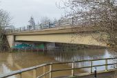
Originally uploaded to Coppermine on Feb 20, 2008 by SteveA30 Blandford Bypass Bridge carrying the A354 / A350 over the river Stour
The Weymouth Tramway - road with full size railway passes under a road bridge. The railway is formally out of use; last use believed to be in 1985.
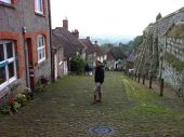
Yours truly on Gold Hill Shaftesbury
Looking south over the Blandford Bypass / River Stour bridge down to the roundabout where the multiplexing A350 and A354 continue on their separate ways once again.
Hiscock's Farm (C) Nigel Mykura
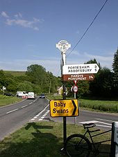
This sign post is at the junction of White Way Lane and the minor road from Hiscock's farm to Marnhull. The blue signs are overstickers on the previous brown signs that indicate this is part of the national Cycle Network route 253. There are now no working farm buildings at Hiscock's Farm and this is one of several large detached houses clustered near the road junction.
Dorset finger-post with grid reference, Sadborow
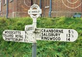
Sixpenny Handley (6 old pence)
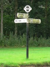
The traditional Dorset finial on this sign gives the location and grid reference. The location, Sixpenny Handley, is shown as '6d Handley'.
It is one of those signs that is rather prone to being stolen, and you can see that parts of it have been replaced.
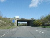
Originally uploaded to Coppermine on Mar 27, 2008 by TS B3390 passes under the A35 at Tolpuddle Ball
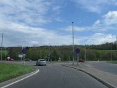
Roundabout, A35 meets A31
Milestone at Miles Cross on the A35 A nice old milestone tucked away in the undergrowth on a bank beside the A35 at Miles Cross. I've driven past it hundreds of times without noticing it, but it seems to be fairly well cared for.
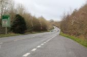
A35, end of the Bridport bypass
Red Signpost near Benville Bridge
Holt- God???s Blessing Green sign
Holt- God???s Blessing Green signpost detail
Alderholt- Bonfire Hill finger-post This traditional Dorset signpost retains its original finial, giving location and grid reference details, although the fingers themselves look like modern replacements.
Alderholt- detail of Bonfire Hill finger-post A close-up of the finial of the finger-post, giving location and grid reference details.
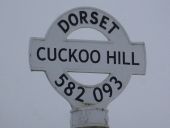
Yetminster- finger-post at Cuckoo Hill This signpost has a finial, containing location name and grid reference, which is a modern replica of the traditional Dorset design.
Yetminster- detail of Cuckoo Hill finger-post A close-up of the finial on top of the finger post. It is a modern replica of the traditional Dorset design, with location name and six-figure grid reference.
An original would have all the characters embossed, rather than just the word Dorset.
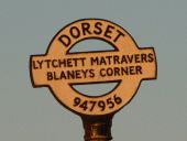
Lytchett Matravers- detail of Blaney???s Corner finger-post A close-up of the finial of the finger-post, giving location and grid reference details.
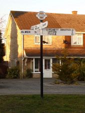
Lytchett Matravers- finger-post at Blaney???s Corner The original Dorset finger-post at
1122762, showing the finial with location and grid reference details.
For a close-up of the finial, see
1741484.
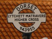
Lytchett Matravers- detail of Higher Cross finger-post A close-up of the finial of the finger-post, giving location and grid reference details.
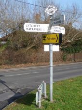
Lytchett Matravers- Higher Cross finger-post This traditional Dorset signpost retains its original finial, giving location and grid reference details. However, the fingers themselves are modern replacements.
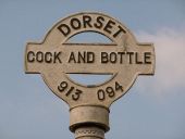
Morden- detail of Cock & Bottle finger-post A close-up of the finial of the finger-post, giving location and grid reference details.
It will be noted that the grid reference SY 913 946 is written in full, without the SY prefix, as 3913 0946. Therefore, while the correct three digits have been used for the easting, the northing should read 946 and not 094 as given on the sign.
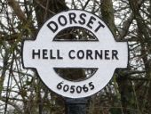
Melbury Bubb- detail of Hell Corner finger-post A closer look at the finial on the fingerpost, showing the location name and six-figure grid reference.
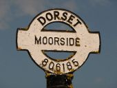
Marnhull- detail of Moorside finger-post A close-up of the finial of the finger-post, giving location and grid reference details.
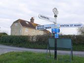
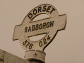
Sadborow- finger-post The fingers on this post are modern replacements, but the traditional Dorset finial has been retained, which gives the location through the centre and the grid reference below.
Sixpenny Handley- finger-post finial detail A close-up of the finial of the finger-post, giving location and grid reference details.
The village name is locally famous for being abbreviated to '6d Handley' on many old signposts and I think this finial has been restored heavily over the years, perhaps owing to sporadic thefts.
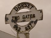
Eggardon Hill- Two Gates A t-junction to the east of Eggardon Hill top, the turning leading to West Compton. The traditional Dorset signpost retains its original finial, giving location and grid reference details. However, the fingers themselves are modern replacements.
Eggardon Hill- Two Gates signpost detail A close-up of the finial of the finger-post, giving location and grid reference details.
Winterbourne Steepleton, fingerposts
Charminster- detail of finger-post finial A close-up of the finial of the finger-post, giving location and grid reference details.
Charminster- old Dorset finger-post One of many surviving Dorset finger-posts, complete with the finial which states location and grid reference.
