Gallery:Dundalk

From Roader's Digest: The SABRE Wiki
Jump to navigation Jump to search


This gallery has no child categories
Dundalk
 
 
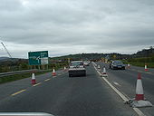
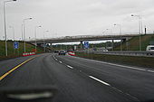
Approaching the new end of the M1 - Coppermine - 3603.JPG
Approaching the new end of the M1

North of Dundalk at Ballymascanlan.

Originally uploaded to Coppermine on Sep 25, 2005 by csd
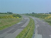
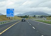
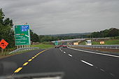
M1 Dundalk bypass - Coppermine - 3600.JPG
M1 Dundalk bypass

With the Cooley mountains in the background

Originally uploaded to Coppermine on Sep 25, 2005 by csd
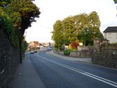
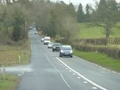
R934 Approaching the traffic lights - Geograph - 1879945.jpg
R934 Approaching the traffic lights
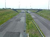
M1 Dundalk Bypass (1) - Coppermine - 1147.jpg
M1 Dundalk Bypass (1)

Looking north from overbridge at Dundalk South junction. The Dundalk Bypass will run to the west of the town from here to Ballymascanlon. Construction of the road is due to commence later in 2003

OP Clangy

Originally uploaded to Coppermine on Apr 20, 2005 by M4Simon
M1 Dundalk South (2) - Coppermine - 1148.jpg
M1 Dundalk South (2)

Looking south towards the southern bridge of the Dundalk South interchange.

OP Clangy

Originally uploaded to Coppermine on Apr 20, 2005 by M4Simon
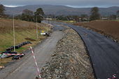
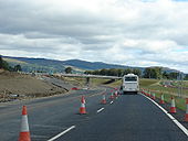
A1 upgrade at the end of the M1 - Coppermine - 6633.jpg
N1/A1 upgrade at the end of the M1

Clearance for the new road can be seen to the left of the picture. The first structure, a bridge carrying a local road, is nearing completion just north of this point. The roundabout which currently forms the end of the improved road is straight ahead. This roundabut will evemtually form part of the dumbbell interchange at this point.

Originally uploaded to Coppermine on Jul 02, 2006 by csd
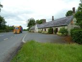
Along the R 173 (C) Robert Ashby - Geograph - 3511102.jpg
Along the R 173 (C) Robert Ashby
The R 173 is a busy road between Dundalk with frequent heavy lorries like this going to and from the port of Greenore, traffic which the Dundalk, Newry and Greenore Railway, which closely follows alongside this road, would have transported in years gone by. Older buildings like the one shown must have their foundations well shaken nowadays
Irish road - Flickr - 5546956309.jpg
N53 West of Hackballscross
Knock road trip 2009-06 - Flickr - 3341604425.jpg
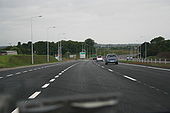
M1 approaching J17 northbound <a href='http://www.knorn.org/onblack.php'>View on black</a>.
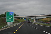
Intermediate junction - Coppermine - 3604.JPG
Intermediate junction

Numbered 17, the N53 junction.

Originally uploaded to Coppermine on Sep 25, 2005 by csd
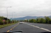
Towards Northern Ireland or not? - Flickr - 9517937845.jpg
If I'm not mistaken, here we just left Dundalk and Neill is driving towards Newry in Northern Ireland. The mountain range is called Cooley Mountains
20160130-1527 - N52 Traffic Calming Ahead 54.0149676N 6.3889502W.jpg
Traffic Calming Ahead sign
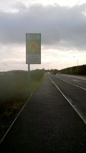
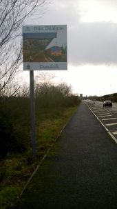
20160130-1526 - Dundalk Gateway Sign - 54.0156398N 6.3884737W.jpg
Dundalk Gateway Sign - N52
20160130-1517 - Road narrows - 54.0161001N 6.3796096W.jpg
Road narrows, near Dundalk Racecourse
20160130-1508 - Out on the marshes - 54.0163288N 6.3696369W.jpg
Out on the marshes, near Dundalk
20160130-1435 - Dundalk Racecourse - 54.0183143N 6.384201W.jpg
15 kmh sign, Dundalk Racecourse
20160130-1433 - No Entry Signs - Dundalk Racecourse - 54.0174947N 6.3850178W.jpg
No Entry Signs - Dundalk Racecourse
20160130-1432 - T Junction Sign - N52 Dundalk - 54.016907N 6.3853015W.jpg
T Junction Sign - N52 Dundalk
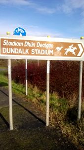
20160130-1430 - Dundalk Stadium - 54.0169058N 6.3871929W.jpg
Dundalk Stadium sign
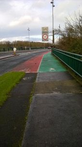
20160130-1417 - N52 bridge over Castletown River, Dundalk - 54.0112394N 6.3921708W.jpg
N52 bridge over Castletown River, Dundalk / Cycle Lanes / Colourful Road surface
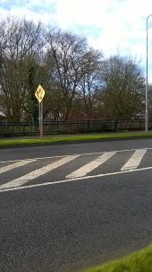
20160130-1415 - N52 Dundalk - Island Ahead - 54.0096929N 6.3922537W.jpg
N52 Dundalk - Island Ahead
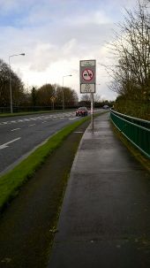
20160130-1414 - No Overtaking sign, N52 Dundalk - 54.009486N 6.391978W.jpg
No Overtaking sign, N52 Dundalk
20160422 1839 - R178 junction outside Dundalk 53.9942305N 6.4482832W.jpg
R178 junction outside Dundalk
20160422 1839 - R178 Dundalk 53.9941813N 6.4484201W.jpg
R178 heading out of Dundalk, just past the M1 underbridge
20160422 1841 - R178 heading out of Dundalk 53.9908051N 6.4712301W cropped.jpg
R178 heading out of Dundalk
20160422 1841 - R178 heading out of Dundalk 53.9904628N 6.4723843W cropped.jpg
R178 heading out of Dundalk
The M1-N1 at Ballymascanlan - Geograph - 304558.jpg
The M1/N1 at Ballymascanlan
A1 signed south of the border - Coppermine - 978.JPG
A1 signed south of the border

This shows the approach to Ballymascanlon roundabout on the N52, which is receiving a lot of attention as construction of the M1 Dundalk Western Bypass progresses. This will be the temporary end of the improved road, as the N1 A1 Dundalk - Newry link only started construction this year. Note the A1 is signed, even though this is south of the border.

Originally uploaded to Coppermine on Apr 17, 2005 by csd
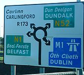
Old end of ROI M1.JPG
This is at the northern end of Dundalk, where the motorway current ends. Note the patching on the M1 part still shows! I assume that the northern section continues as a motorway at least for some stage - so this roundabout will have M1 to belfast and M1 to dublin!. I wonder if it would be appropriate for those designing the sign to have M1 (A1) Belfast. Originally uploaded to Coppermine on Apr 12, 2007 by michaelsa
N1 Border-Dundalk 15th June 2007 - Coppermine - 12991.JPG
N1 Border-Dundalk 15th June 2007

Southbound. Here's where we lose the non-motorway traffic. So the motorway starts at this point. Where are the chopsticks?

Originally uploaded to Coppermine on Jun 15, 2007 by mackerski
N1 Border-Dundalk 15th June 2007 - Coppermine - 12990.JPG
N1 Border-Dundalk 15th June 2007

Southbound. It's magic! A motorway starting casually a few hundred metres beyond the last exit for non-motorway traffic. Good to see Louth County Council living up to their usual high standards of signposting.

Originally uploaded to Coppermine on Jun 15, 2007 by mackerski
N1 Border-Dundalk 15th June 2007 - Coppermine - 12980.JPG
N1 Border-Dundalk 15th June 2007

Southbound, approaching M1

Originally uploaded to Coppermine on Jun 15, 2007 by mackerski
N1 Border-Dundalk 15th June 2007 - Coppermine - 12993.JPG
N1 Border-Dundalk 15th June 2007

Southbound, approaching M1. Pay attention for some really sloppy signage. The first is already visible - 'M1' should not be in brackets, since this fork is the last exit before the motorway. But keep watching...

Originally uploaded to Coppermine on Jun 15, 2007 by mackerski
End of the M1 heading north - Coppermine - 11418.jpg
End of the M1 heading north

Traffic is now diverted off at the Ballymascanlon interchange. Previously it went straight through under the bridge in the distance. This slip road is newly completed as part of the N1/A1 project. Taken 29.04.07

Originally uploaded to Coppermine on Apr 29, 2007 by csd
Northern terminus of the M1 - Coppermine - 7496.JPG
Northern terminus of the M1

New off-slip for the N52 interchange north of Dundalk (J18) under construction. The southbound carriageway will be constructed under the bridge in the background (currently the road comes down the SB sliproad out of shot to the right.

Originally uploaded to Coppermine on Sep 03, 2006 by csd
End of the M1 - Coppermine - 3602.JPG
End of the M1

The A1/N1 link will continue straight ahead. Clearance work currently underway.

Originally uploaded to Coppermine on Sep 25, 2005 by csd
ADS for the last M1 junction heading north. - Coppermine - 14363.JPG
ADS for the last M1 junction heading north.

Just before the start of the new N1/A1 link road HQDC.

Originally uploaded to Coppermine on Jul 29, 2007 by csd
The southern bridge on the Junction 16 roundabout - Geograph - 1904403.jpg
The southern bridge on the Junction 16 roundabout
20161227-1523 - Faughart Roundabout - 54.03723N 6.3864712W.jpg
Faughart Roundabout
Unknown (prototype?) early 'Warboys' signage on N1 near Dundalk c.1973 - Coppermine - 5751.JPG
Unknown (prototype?) early 'Warboys' signage on N1 near Dundalk c.1973 Originally uploaded to Coppermine on Apr 30, 2006 by A42_Sparks
20190406-1850 - Hill Street Bridge, Dundalk 53.997482N 6.405213W.jpg
Hill Street Bridge, Dundalk
20190406-1247 - Greengates Cross, looking East 53.956659N 6.386421W.jpg
Greengates Cross, looking East
20190406-1302 - Thistle Cross, Ravensdale 54.044183N 6.365865W.jpg
Thistle Cross, Ravensdale
The Big Bridge, Dundalk - Geograph - 805783.jpg
The Big Bridge, Dundalk Until 1996, when a new bridge opened downstream, this bridge carried the Dublin-Belfast road over the Castletown River.
20190820-1835 - St Johns Bridge across the Castletown River 54.025784N 6.428553W.jpg
St Johns Bridge across the Castletown River
20190820-1836 - St Johns Bridge across the Castletown River 54.026131N 6.429025W.jpg
St Johns Bridge across the Castletown River
 

SABRE - The Society for All British and Irish Road Enthusiasts
Discuss - Digest - Discover - Help