Gallery:Fantasy Maps
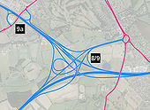
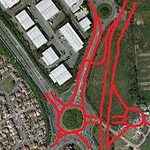
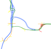
Now pay attention boys and girls. From what I can gather no sabristi has yet attempted to have a go at redesigning this junction. What I've done is removed the horrible traffic light controlled roundabout and replaced it with a tangle of slip roads. For the first time in nearly 40 years it will be possible for A404(M)-M4(E) traffic to use the original alignment of the A4(M). Because J9a is so close I've had to add C/D roads to the eastbound carriageway to avoid weaving.
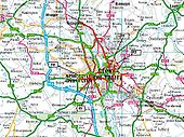
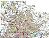
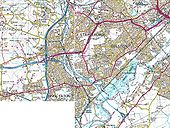
Originally uploaded to Coppermine on Mar 19, 2007 by TruveloA way up the A34 into Manchester. Including the M635 or SOSWBMALR (Stockport outer south-Western bypass Manchester Airport Link Road)
Originally uploaded to Coppermine on Nov 07, 2006 by bucephalusA southern extension of the A329(M) to the M3 J3, forming a motorway alternative to the M25 J12-J15. It bypasses Bracknell to the west then follows the B3430 from the A3095 junction (which takes advantage of tow existing roundabouts) to the A322 junction where it crosses the A322 (which would lose its primary route status) and runs parallel to it until it meets the M3 at junction 3, where the carriageways flare to allow a possible future flyover with an extension to the south. Originally uploaded to Coppermine on Mar 25, 2006 by Rubberduck
This page includes a scan of a non-free copyrighted map, and the copyright for it is most likely held by the company or person that produced the map. It is believed that the use of a limited number of web-resolution scans qualifies as fair use under United States copyright law, where this web page is hosted, as such display does not significantly impede the right of the copyright holder to sell the copyrighted material, is not being used to generate profit in this context, and presents information that cannot be exhibited otherwise.
If the copyright holder considers this is an infringement of their rights, please contact the Site Management Team to discuss further steps.
Apologies for using MS Paint! I reckon the main traffic flow here is Birmingham-Oxford, so here's how adding a couple of slip roads could ease the pain. Originally uploaded to Coppermine on Sep 14, 2005 by rusty
This page includes a scan of a non-free copyrighted map, and the copyright for it is most likely held by the company or person that produced the map. It is believed that the use of a limited number of web-resolution scans qualifies as fair use under United States copyright law, where this web page is hosted, as such display does not significantly impede the right of the copyright holder to sell the copyrighted material, is not being used to generate profit in this context, and presents information that cannot be exhibited otherwise.
If the copyright holder considers this is an infringement of their rights, please contact the Site Management Team to discuss further steps.
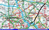
This is one I've wondered about for a long time. The M5 replaced the A38 as the main road from the South West to the Midlands but it was never properly joined up with the A38 North when it got to B'ham. To my mind, this is one reason for the excess pressure on certain bits of motorway. The obvious thing to do would be to continue the M5 (perhaps as an A road - I don't know what number it could be given) straight up around Barr Beacon and across to the A38 at Wall. Was this ever planned or suggested? Dadge C Originally uploaded to Coppermine on Apr 23, 2005 by M4Simon
This page includes a scan of a non-free copyrighted map, and the copyright for it is most likely held by the company or person that produced the map. It is believed that the use of a limited number of web-resolution scans qualifies as fair use under United States copyright law, where this web page is hosted, as such display does not significantly impede the right of the copyright holder to sell the copyrighted material, is not being used to generate profit in this context, and presents information that cannot be exhibited otherwise.
If the copyright holder considers this is an infringement of their rights, please contact the Site Management Team to discuss further steps.
1. Build a new section of A4040 outer ring to take traffic off local roads in Kings Heath, Cotteridge and Bournville. 2. Upgrade the A441 from Stirchley into town to take traffic off the A435 and A34.
OP DadgeCity on 11/20/2003
Originally uploaded to Coppermine on Apr 23, 2005 by M4SimonExpansion of M1 Junction 1 to allow grade-separated movement directly to NCR Westbound
Originally uploaded to Coppermine on Sep 14, 2006 by alantanPosted by Stack_Interchange on 11/17/2003
Originally uploaded to Coppermine on Apr 29, 2005 by M4SimonWhat a Northern bypass of Rosyth might have looked like had the A823(M) continued West. Originally uploaded to Coppermine on Jun 19, 2006 by Glen
This page includes a scan of a non-free copyrighted map, and the copyright for it is most likely held by the company or person that produced the map. It is believed that the use of a limited number of web-resolution scans qualifies as fair use under United States copyright law, where this web page is hosted, as such display does not significantly impede the right of the copyright holder to sell the copyrighted material, is not being used to generate profit in this context, and presents information that cannot be exhibited otherwise.
If the copyright holder considers this is an infringement of their rights, please contact the Site Management Team to discuss further steps.
At the M4 the existing bridge carries southbound traffic and a new bridge carries northbound traffic. The most important turning movements are between the M4 West and Westerleigh Rd South, as these effectively bypass the overloaded northern sector of the A4174. Both these movements are freeflow. Access to the M4 East has also been provided.
Originally uploaded to Coppermine on Jan 06, 2010 by jackalHere I've run the mainline of the A4174 Avon Ring Road onto a realigned Westerleigh Rd, heading for the M4. Access to the northern portion of the ring road is via a dumbbell GSJ.
Originally uploaded to Coppermine on Jan 06, 2010 by jackalHere I have by-passed Marcham to the South, with an at grade roundabout at the Eastern end, and a traffic light controlled crossroads in the middle. Kingston Bagpuize is given a By-pass to the West, which will end at a signal controlled t junction. Originally uploaded to Coppermine on Oct 24, 2006 by Dave908
This page includes a scan of a non-free copyrighted map, and the copyright for it is most likely held by the company or person that produced the map. It is believed that the use of a limited number of web-resolution scans qualifies as fair use under United States copyright law, where this web page is hosted, as such display does not significantly impede the right of the copyright holder to sell the copyrighted material, is not being used to generate profit in this context, and presents information that cannot be exhibited otherwise.
If the copyright holder considers this is an infringement of their rights, please contact the Site Management Team to discuss further steps.
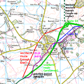
Well, it's fantasy now... here are the 1991 planned routes (roughly). The bypass, which had been given planning permission and even got as far as having complusory purchase orders and some effort into finding contractors to build it just 5 years before, needed redoing from scratch as the planning permission expired. In 86 it was WS2/D2, in 91 it was Trunk GS D2 and possibly motorway at some points during the year. It was going to be part of an E-W route from Oxford to the East Coast ports. Originally uploaded to Coppermine on Aug 31, 2006 by sabristo simon
This page includes a scan of a non-free copyrighted map, and the copyright for it is most likely held by the company or person that produced the map. It is believed that the use of a limited number of web-resolution scans qualifies as fair use under United States copyright law, where this web page is hosted, as such display does not significantly impede the right of the copyright holder to sell the copyrighted material, is not being used to generate profit in this context, and presents information that cannot be exhibited otherwise.
If the copyright holder considers this is an infringement of their rights, please contact the Site Management Team to discuss further steps.
Here's a simple solution for this traffic hotspot. Dual the A4440, GSJ all the roundabouts and make it freeflow onto the M5.
Originally uploaded to Coppermine on Feb 14, 2007 by TruveloA slightly unconventional approach to the motorways around Birmingham and the Black Country. Includes:
- Western Orbital (avoiding the Lickey and Clent Hills!)
- Removal of inappropriate urban motorways
- New northern distributor (A434) replacing part of urban M6
- Studley by-pass motorway, with M42 J3 replaced to avoid funneling London-Birmingham traffic through King's Heath.
aristophanes2000@hotmail.com Jam35
Originally uploaded to Coppermine on May 05, 2005 by Jam35Based on the HA proposal I present this much improved version with more freeflow. The link road to the airport is part of the HA scheme but whereas the HA version has an at-grade traffic light junction with the A45, my version has it above the A45 with a slip road for A45(E) and A423. At Tollbar End the HA scheme has either an A45 or A46 underpass but mine has A46 and A45(W) underpasses. Also proposed by HA but later dropped for environmental reasons was direct A46 links at Stivichall (the GSJ to the west).
Originally uploaded to Coppermine on Jan 27, 2007 by TruveloWhat M90 J2 might have looked like had the original plans of the main route to Kirkcaldy been built going East from here. Originally uploaded to Coppermine on Jun 19, 2006 by Glen
This page includes a scan of a non-free copyrighted map, and the copyright for it is most likely held by the company or person that produced the map. It is believed that the use of a limited number of web-resolution scans qualifies as fair use under United States copyright law, where this web page is hosted, as such display does not significantly impede the right of the copyright holder to sell the copyrighted material, is not being used to generate profit in this context, and presents information that cannot be exhibited otherwise.
If the copyright holder considers this is an infringement of their rights, please contact the Site Management Team to discuss further steps.
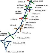
Together with planned improvement to A38 around Derby, and possible improvement to A38/M1 junction, would complete high quality route for traffic between the Black Country/South West and Derby/North East. Traffic for the Black Country and SW would be signed from M1 to use A38/M5 rather than the heavily congested M1/A42/M42/M6. It would also relieve local routes such as A461, A452/A4041, and at-grade A38 between Lichfield and Birmingham. Apologies for the low standard of the drawing!
Originally uploaded to Coppermine on Feb 13, 2008 by jackalThis is my idea to improve junctions 9 and 10 of the M3, giving free-flow access to/from the A34 and A31, by combining them in one fork just south of junction 9. The current junction 10 would close and the fork would become J10 (to avoid mucking up the numbering), with the current A31 south of the middle roundabout becoming a single-carriageway B-road (not sure what the number is). I've also grade separated the A31/A272/B3404 junction.
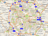
Originally uploaded to Coppermine on Sep 14, 2007 by Rubberducka londonesque approach to the West Midlands. BNRR and Western orbital routes built using the money saved from demlishing the elevated sections of the M6, M5 and A38(M)
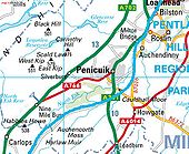
Originally uploaded to Coppermine on Aug 01, 2007 by bucephalusOf course it wouldn't be too hard to dual the 702 on its current course NW of Penicuik, but there's something to be said for rerouting it onto the 701 as it arrives at the Edinburgh bypass.
Posted by DadgeCity on 3/1/2004
Originally uploaded to Coppermine on Apr 23, 2005 by M4SimonMy go at an improvement at J5 with access to M20/M26 from A21 provided and short cut and cover tunnel.
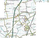
Originally uploaded to Coppermine on Oct 06, 2008 by Fluid DynamicsMy impression of the route that a future upgrade of the A46 between Lincoln and Market Rasen could take. Originally uploaded to Coppermine on Nov 08, 2007 by Birchington
This page includes a scan of a non-free copyrighted map, and the copyright for it is most likely held by the company or person that produced the map. It is believed that the use of a limited number of web-resolution scans qualifies as fair use under United States copyright law, where this web page is hosted, as such display does not significantly impede the right of the copyright holder to sell the copyrighted material, is not being used to generate profit in this context, and presents information that cannot be exhibited otherwise.
If the copyright holder considers this is an infringement of their rights, please contact the Site Management Team to discuss further steps.
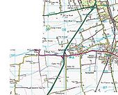
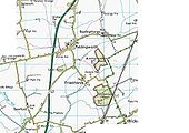
My impression of the route that a future upgrade of the A46 between Lincoln and Market Rasen could take. Originally uploaded to Coppermine on Nov 08, 2007 by Birchington
This page includes a scan of a non-free copyrighted map, and the copyright for it is most likely held by the company or person that produced the map. It is believed that the use of a limited number of web-resolution scans qualifies as fair use under United States copyright law, where this web page is hosted, as such display does not significantly impede the right of the copyright holder to sell the copyrighted material, is not being used to generate profit in this context, and presents information that cannot be exhibited otherwise.
If the copyright holder considers this is an infringement of their rights, please contact the Site Management Team to discuss further steps.
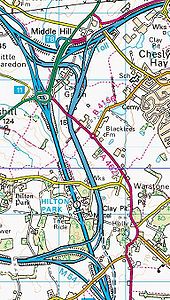
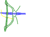
liks the M54 with the M6 Toll, bypasses Hilton sevices, and provides an alternative southbound link to the M6 shown in broken lines. pricey but sexy Originally uploaded to Coppermine on Jan 02, 2007 by bucephalus
This page includes a scan of a non-free copyrighted map, and the copyright for it is most likely held by the company or person that produced the map. It is believed that the use of a limited number of web-resolution scans qualifies as fair use under United States copyright law, where this web page is hosted, as such display does not significantly impede the right of the copyright holder to sell the copyrighted material, is not being used to generate profit in this context, and presents information that cannot be exhibited otherwise.
If the copyright holder considers this is an infringement of their rights, please contact the Site Management Team to discuss further steps.
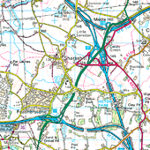
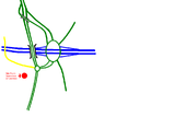
a bit overkill on the M6 junction perhaps, but I feel that the fabled M54-M6T will look something like this - a grade seperated all purpose route simply bypassing the A460 between the M54 and M6, with some changes near the M6T. I guess we have to wait until the plans come out... Originally uploaded to Coppermine on Jul 12, 2006 by sabristo simon
This page includes a scan of a non-free copyrighted map, and the copyright for it is most likely held by the company or person that produced the map. It is believed that the use of a limited number of web-resolution scans qualifies as fair use under United States copyright law, where this web page is hosted, as such display does not significantly impede the right of the copyright holder to sell the copyrighted material, is not being used to generate profit in this context, and presents information that cannot be exhibited otherwise.
If the copyright holder considers this is an infringement of their rights, please contact the Site Management Team to discuss further steps.
Original plan, pre-bats.
Originally uploaded to Coppermine on Dec 02, 2005 by doby-smithRevised Plan because of an 'internationally important bat roost'
Originally uploaded to Coppermine on Dec 02, 2005 by doby-smiththe alternative solution
Originally uploaded to Coppermine on Nov 11, 2006 by bucephalusA completion and grade seperation of the A47 dual carriageway section between the A1 and Peterborough, with a small upgrade to the A1/A47 junction. Originally uploaded to Coppermine on Jan 08, 2008 by Birchington
This page includes a scan of a non-free copyrighted map, and the copyright for it is most likely held by the company or person that produced the map. It is believed that the use of a limited number of web-resolution scans qualifies as fair use under United States copyright law, where this web page is hosted, as such display does not significantly impede the right of the copyright holder to sell the copyrighted material, is not being used to generate profit in this context, and presents information that cannot be exhibited otherwise.
If the copyright holder considers this is an infringement of their rights, please contact the Site Management Team to discuss further steps.
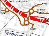
This is an adaption of part of the Welsh Assembly's proposal for the A55/A494 junction. Instead of the A494 joining the A55 at Pinfold Lane, it crosses it at a new Liverpool Road bridge and joins its current course at the Ewloe Roundabout (not shown).
Originally uploaded to Coppermine on Oct 20, 2007 by kieronan optimised north staffordshire road system
Originally uploaded to Coppermine on Oct 04, 2006 by bucephalusThe at grade A5117/A550 junction has been replaced with a dumbbell junction, which also provides access to the A548 and the Deeside Industrial Park, because the A548/A550 junction has been converted so that traffic can only exit northbound and enter southbound. This is to help control weaving problems which could occur if that junction was left as full access. The A5117 has also been moved onto a new alignment through the new junction.
Originally uploaded to Coppermine on Oct 11, 2006 by Dave908The A5225 (if it ever happens) will run from M6 J26 to A579 Atherleigh Way at Leigh. This is how the first section should look. The road, i presume, will pass under current roads on the route. The link road between the A49 and A571 has also been completed (it is a stub at the moment). Also, the new Westwood Park business park link road has been added. Also, the A577 through Pemberton has been downgraded to a normal A road.
Originally uploaded to Coppermine on Sep 11, 2006 by Dave908I got stuck in a big traffic jam, and thought 'heh land here is flat and cheap, why no bypass?' Here it is, a bit overkill perhap, being fully grade seperated, even if the junctions with most of the unclass roads are naff. way over the top with A16/A52 junctions in middle of bypass and A17 junction at the bottom.
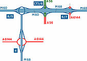
Originally uploaded to Coppermine on Apr 05, 2005 by sabristo simonA bit of fantasy here as plans for the Manchester Western and Northern Relief Road show the road going much further west. M68 J4 is the current end of the A6144(M) - made into a r'bt junction. A6144(M) is upgraded to D3 as far as the M60. A slightly confusing situation then occurs. The HA is currently widening M60 between J5 and 8, providing 4 c'ways between 6 and 8. Access to J6 and 7 will be from the outside 2 c'ways as a continuation of my M68. From J5 to the Northern terminus at J7, the Mway is D2
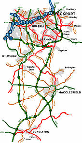
Originally uploaded to Coppermine on Apr 18, 2005 by M4SimonA possibly slightly far-fetched future scenario. Northern end of Congleton bypass is extended to Macclesfield, A34 dualled to Southern edge of Alderley Edge bypass. A new Macclesfield bypass has been built - A523 now dualled as far as southern edge of SEMMMS Poynton bypass. SEMMMS A555 scheme also shown. Some of the old A-roads have been extended to fill bypassed A-roads, and several B road numbers have been created / re-used. OP RickyB_UK
Originally uploaded to Coppermine on Apr 16, 2005 by M4SimonThe awful junction 5 has been rebuilt to make a bit more sense. It has been turned into a roundabout interchange. However, to retain some of Skelmersdales quirkyness the eastbound entry slip is seperate from the rest of the interchange, accessed further up the A577, which uses the present eastbound access slip road.
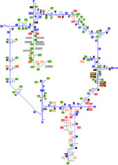
Originally uploaded to Coppermine on Nov 01, 2006 by Dave908This is my proposed renumbering of the Manchester motorways, which will end the 2 part M62 situation. See 'Comments' on this page for more details.
[NOTE: This was originally designed before M62 J8 was opened at Burtonwood Services]
Originally uploaded to Coppermine on Apr 04, 2005 by Gareth Thomas