Gallery:Guildford
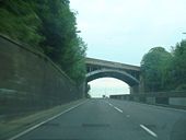
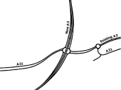
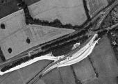
Lovely bit of 1930's dual carriageway at Guildford. The bridge carries the A31 down the hill, leftwards, on the last leg of its journey from Bere Regis in Dorset. The date on the bridge is 1934. As the streetlights indicate, the slip up to A31 goes straight on and, the A3 veers sharply to the right and downhill.
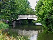
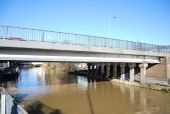
Originally uploaded to Coppermine on Jul 19, 2007 by SteveA30The A3 flyover crossing the River Wey Navigation from just north of the Woodbridge Road Bridge
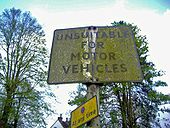
Although most of the original colour is obscured by moss this guards a steep track just off Portsmouth Road on the right coming into town.
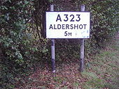
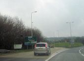
Originally uploaded to Coppermine on May 10, 2009 by DavidNW9The sign was made as A321 and painted the 2 over it, although not much like the other one.
Originally uploaded to Coppermine on Feb 09, 2009 by DavidNW9The bridge carries the A25 (Woodbridge Road) across the navigation, and replaced an earlier wooden bridge. <a href='http://www.geograph.org.uk/photo/1447113'>SU9950 : Looking south to Woodbridge Bridge, Guildford</a>.
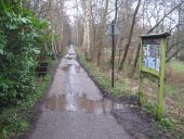
This is the view looking along the trackbed of the former London Brighton & South Coast Railway line between Horsham and Guildford. The line lasted for 4 months short of 100 years, opening in October 1865 and closing, as part of the Beeching cutbacks, in June 1965. Today the trackbed forms part of National Cycle Network Route 22.
Behind the photographer is a bridge where the railway crossed over Cranleigh Waters, a tributary of the River Wey. The triangular warning sign on the right advises horseriders coming this way to dismount before the bridge, using the concrete dismounting block on the left.
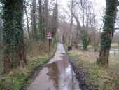
This is the view looking along the trackbed of the former London Brighton & South Coast Railway line between Horsham and Guildford. The line lasted for 4 months short of 100 years, opening in October 1865 and closing, as part of the Beeching cutbacks, in June 1965. Today the trackbed forms part of National Cycle Network Route 22.
Up ahead is a bridge where the railway crossed over Cranleigh Waters, a tributary of the River Wey. Note the advice to horseriders to dismount, using the concrete dismounting block on the right.
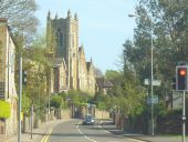
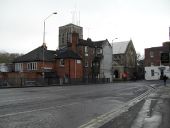
Main route in central Guildford, skirting the town centre on its eastern side between Epsom and London Roads. Christ Church dominates the curving road.
If the copyright holder considers this is an infringement of their rights, please contact the site management team to discuss further steps.
The River Wey is a major tributary of the River Thames and joins it at Weybridge. It comprises two main tributaries, the North Wey and South Wey. The North Wey rises near Alton and flows through Farnham before joining the South Wey near Shalford, just south of Guildford. The South Wey rises on Black Down near Haselmere. <a title='http://en.wikipedia.org/wiki/River_Wey' rel='nofollow' href='http://en.wikipedia.org/wiki/River_Wey'>Link</a><img style='padding-left:2px;' alt='External link' title='External link - shift click to open in new window' src='http://s1.geograph.org.uk/img/external.png' width='10' height='10'/>

