Gallery:Hereford
From Roader's Digest: The SABRE Wiki
Jump to navigation
Jump to search
Places in the West Midlands region > Hereford
This gallery has no child categories
Hereford
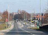
A49, south Hereford
Heading towards the new traffic signals at the Bullingham Lane junction. Ahead is the square tower of the cathedral.
Heading towards the new traffic signals at the Bullingham Lane junction. Ahead is the square tower of the cathedral.
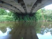
Greyfriars Bridge
View northwards from the riverside footpath. The bridge was built in 1966 to carry the dual carriageway over the Wye and relieve traffic pressure from the Old Bridge.
View northwards from the riverside footpath. The bridge was built in 1966 to carry the dual carriageway over the Wye and relieve traffic pressure from the Old Bridge.
Shrewsbury to Hereford following the A49
From 'The Contour Road Book of England (Western Division)', 1911.
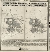
Originally uploaded to Coppermine on Jan 07, 2008 by FosseWayA49 between Hereford and Ross
If the copyright holder considers this is an infringement of their rights, please contact the site management team to discuss further steps.
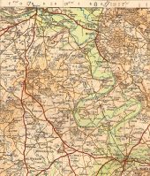
OS Half Inch sheet 27, published 1926, minor corrections to 1932, print code 3000/27 3250/32 Originally uploaded to Coppermine on Jan 04, 2008 by FosseWay
This page contains scans from a map that is believed may be out of copyright according to UK Crown Copyright, UK Copyright Law for other maps published in the United Kingdom, or Irish Government Copyright, is not being used to generate profit in this context, and presents information that cannot be exhibited otherwise.If the copyright holder considers this is an infringement of their rights, please contact the site management team to discuss further steps.
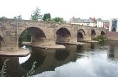
Wye Bridge, Hereford This is a 15th century six-arched stone bridge on the River Wye, which carried the A49 until 1966.
