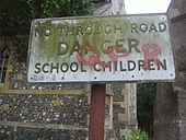
Pre-Worboys information Elstree
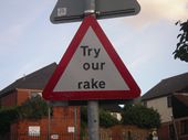
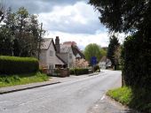
A dual purpose sign for the no through road and school in St Nicholas Close just off the old A5 in Elstree.
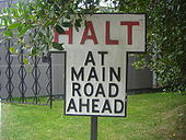
Originally uploaded to Coppermine on Jun 19, 2009 by DavidNW9 Halt sign Bushey
This was found at a busy car park exit that isn't bothered with government regulations. There was normally a red circle on top but this appeared to have been made without one originally.
Originally uploaded to Coppermine on Jun 18, 2009 by DavidNW9 Brookmans Park
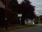
While out walking, I saw a pre-warboys sign on the road connecting Brookmans Park to Welham Green.
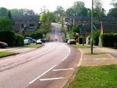
Originally uploaded to Coppermine on May 25, 2006 by BigToe The big dip, Knightsfield in Welwyn Garden City. The hill was originally built with a heating element.
Originally uploaded to Coppermine on Apr 29, 2007 by M4Simon
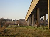
A10 - Kingsmead Viaduct
View from underneath the Kingsmead Viaduct, Ware; heading north towards Royston
Originally uploaded to Coppermine on Feb 18, 2008 by c2R A10 Puckeridge Bypass
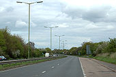
Old SOX lighting still in service which may be the originals from when the bypass was built. They are painted in the Hertfordshire shade of green.
Originally uploaded to Coppermine on May 02, 2006 by Truvelo A5/A6 Peahen
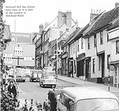
Old picture when eggs were eggs and the A5 and A6 still went through St Albans
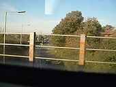
Originally uploaded to Coppermine on Aug 21, 2005 by Tom A507 near Baldock station
looking north from a London-bound train just leaving the station
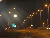
Originally uploaded to Coppermine on Nov 05, 2006 by Sunil_of_Yoxley Travelling northbound on the M1 between J8-9 at night.
Heading towards J8 on the A414 as moonlight shines down on the road.
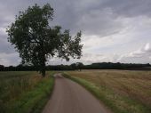
Marshalls Lane from High Cross to Sacombe Green (looking West)
Grossalmerode 798km - German town twinning sign on A10 at Royston Town Hall
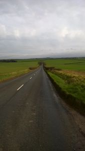
B1039 looking towards Barley
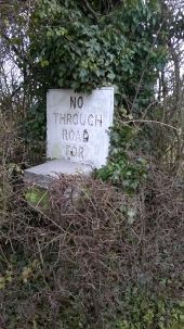
Pre Warboys 'No Through Road For ...' sign, hidden in the undergrowth
Not sure what the box is underneath it either!
Fox and Hounds, Barley, with pub sign across the unclassified road which terminates on the B1368 behind
No Through Road sign in Barley
B1039 Turn off to Stay On at Barley
B1039 Turn off to Stay on, Barley
B1368/B1039 crossroads at Barley.
All four flag signs were previously on the post with the cycle sign on it. These have now been split out in the arragement here with signs everywhere.
The B1039 here gives way to the B1368. Royston is straight ahead.
Route of new A10 at Thundridge looking South
A10 at Wadesmill being reconstructed. Sections of the road required re-building after initial completion and white lining as the road surface began to subside
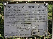
1899 - Old bridge restriction sign, warning against Ponderous Carriages
near Cromer
Originally uploaded to Coppermine on Sep 30, 2006 by c2R Petrol station, High Road, High Cross
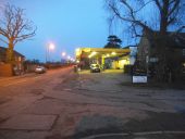
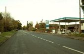
This is looking north, on the former A10 at High Cross
Filling Station on the original A10 This section of the old A10 is called Cambridge Road. It follows the course of a Roman road known as Ermine Street and, at one time, the A10 followed the course of this road for miles. Now, some sections, like this one, have been by-passed by the new A10 that runs parallel to it.
High Street, Barley With petrol station sign.
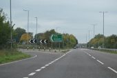
A10 Moles Interchange, Southbound
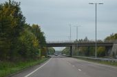
Moles Interchange Bridge, looking north
This bridge carries the A1170 over the A10 at the Moles Interchange. The late 1970s Ware bypass previously terminated here, with the dual carriageway narrowing to one lane in each direction immediately after the bridge and turning to the left. The bridge carried the northbound A1170 from Ware, and the two roads merged in a limited access junction heading north.
Since the completion of the High Cross bypass, the bridge has been converted to two way traffic and forms a compact grade separated junction
EuroCommercials Victim of the bypass. EuroCommercials yard, now empty, was once full of secondhand vehicles for sale. The reduced traffic along Ermine Street has led to reduced trade. This site has since been replaced with housing.
Roundabout at southern terminal of M.1 near Aldenham, Herts
Originally uploaded to Coppermine on Apr 14, 2005 by M4Simon
A1000 approach to A1(M) junction 6
Note the motorway signage, particularly the left hand one. There is a larger version of that sign in the A1(M) album.
Originally uploaded to Coppermine on Mar 06, 2006 by M4Simon Turnford Interchange Overbridges, A10
New River Arms The New River Arms, High Road Turnford and following what was reported as a ??300k refurbishment about 2 years ago is also now known as the New River Carvery.
Strangely it closed about 6 months ago.
Link road between New River Arms roundabout and A10 Looking east towards the A10 Trunk Road from the New River Arms roundabout, Turnford on the old Great Cambridge Road and Turnford High Road.
The Sun, Public House, Hoddesdon This McMullan pub was built on the same site as the old pub of the same name.
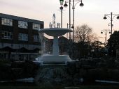
Town centre fountain The ornamental fountain is on a roundabout at the junction of Turners Hill and College Road. It is seen here at dusk.
Howe Fencing at Horse Cross - A shed shop.
Bengeo Rural Civil Parish- Anchor Lane Anchor Lane forms a section of the road leading to Wadesmill and Thundridge from Hertford, and in this square is not near any particular village or hamlet. It is however in Bengeo Rural Civil Parish, hence the title. There is a public house called the Anchor in Wadesmill but I do not know if the pub was named after the road or vice versa.

