Gallery:Kent
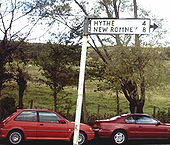
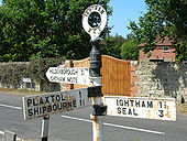
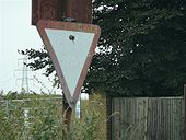
Detail of pre-Worboys sign on triangle at the meeting of three unclassified roads between Littlebourne and Upstreet. Taken 2nd June 2008.
Originally uploaded to Coppermine on Jun 02, 2008 by YorklettsSee other Lenham photo.
Originally uploaded to Coppermine on Jun 11, 2006 by Simon A6(M)The A28 now bypasses this village, but one finger on this sign seems to have hung on well past its sell-by date!!
Originally uploaded to Coppermine on Nov 19, 2005 by agc2070Just over a mile away from the busy A249 lies the village of Thurnham and at its crossroads is this fingerpost. The northward bound road is signed elsewhere as a dead end, despite the OS showing it connecting to the A249...
Originally uploaded to Coppermine on May 22, 2005 by DarrenThis lavatorial pre-Worboys sign can be seen in Churchfield Way in the picturesque village of Wye (Kent).
Originally uploaded to Coppermine on Apr 13, 2005 by agc2070This sign looks to have been replaced before 2009 - C2r December 2015
This pre-Worboys finger can be found at the junction of Oxenturn Road and Bridge Street in the picturesque village of Wye. There is a more modern signpost here also, but this studded sign, being low to the ground, cleverly escaped the culling!
Originally uploaded to Coppermine on Mar 11, 2005 by M4SimonThis one can be spotted at the bottom of Lympne Hill in the village of West Hythe. The hills behind are known as 'The Roughs'
OP Adam
Originally uploaded to Coppermine on Mar 11, 2005 by M4SimonA remarkable sign, not least due to the unusual spellings of 'Stanford' and 'Stowting'. Note also that the location, Postling, appears at the top of all three fingers.
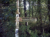
Originally uploaded to Coppermine on Mar 11, 2005 by M4SimonThis dirty specimen has 'Saltwood' at the top of all three fingers, with one finger completely blacked out because the M20 sliced through the lane it points along in the early eighties. Saltwood is one mile north of the town of Hythe.
OP Adam
Originally uploaded to Coppermine on Mar 11, 2005 by M4SimonThis old and rather dirty pre-Worboys sign can be found hidden away in the bushes at the bottom of New Road Hill, Aldington, Kent
OP Adam
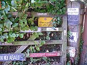
Originally uploaded to Coppermine on Mar 11, 2005 by M4SimonAn interesting collection of signs adorn a gate in St Nicholas at Wade, Kent. International 'Beware of the dog' signs are accompanied by a Welsh 'No Parking' plate.
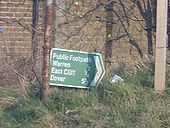
Originally uploaded to Coppermine on May 08, 2009 by YorklettsThis is fairly unusual. It's a sign for a footpath, for pedestians, yet is green and has mileages. Located in Capel-le-Ferne, Kent.
Originally uploaded to Coppermine on Apr 04, 2006 by Gareth ThomasEntering the eastern bore. Note the enclosed cut-and-cover section and wig wags still with white borders.
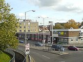
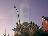
Originally uploaded to Coppermine on Oct 16, 2008 by sotonsteveThis view is of the corner of the Riding Gate roundabout on the A28?A2050 Canterbury Ring Road multiplex showing several ages of lighting. A single column Alpha 3, a bastardised double showing both Alpha 3 and SGS203 on the same column and a post-top SGS203 in the background. The Ring Road here dates from 1969 and some columns may well be original.
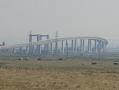
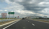
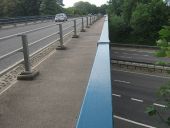
Originally uploaded to Coppermine on Nov 11, 2006 by Brenley CornerThe A249 'Sheppy Crossing' Bridge, opened 2006.
Originally uploaded to Coppermine on Feb 21, 2007 by Gareth ThomasThe A249 'Sheppy Crossing' Bridge, opened 2006.
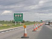
Originally uploaded to Coppermine on Feb 21, 2007 by Gareth ThomasInstalled towards the end of May 2006, this 'no' sign harks back to an earlier age!
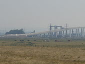
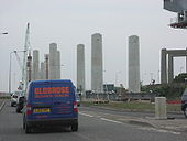
Originally uploaded to Coppermine on May 29, 2006 by DarrenA view of the new bridge supports along the A249 towards the current Kingsferry Bridge (taken in mid May)
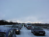
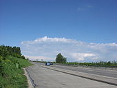
Originally uploaded to Coppermine on Jun 16, 2005 by DarrenA view northwards along the southbound carriageway by the Kent County Showground. Normally traffics slows as it approaches a downhill section filled with twists and turns, but this time the road was closed due to snow.
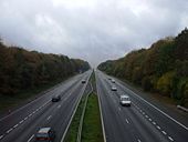
Originally uploaded to Coppermine on May 09, 2005 by DarrenOriginally posted on a weather forum, this shows the A249 southbound at the Bobbing grade-seperated junction. Although the northern part of the dual carriageway is now a mess thanks to the new bridge, this part is much as it was when it opened in the late 90s.
Originally uploaded to Coppermine on May 09, 2005 by DarrenA view along the northbound carriageway of the A249 just past the Bobbing junction. The picture was taken on a Saturday afternoon - on weekdays traffic often backs up all the way to Sheppey (a few miles away).
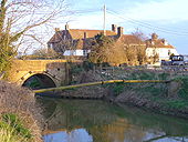
Originally uploaded to Coppermine on May 09, 2005 by DarrenThe road is Appledore Road, the principal road into the Isle of Oxney from the north. The watercourse is called the Reading Sewer. Originally it was much wider and part of the River Rother which flowed north of Oxney. However, according to this <a title='http://www.villagenet.co.uk/history/0000-romneymarsh.html' rel='nofollow' href='http://www.villagenet.co.uk/history/0000-romneymarsh.html'>Link</a><img style='padding-left:2px;' alt='External link' title='External link - shift click to open in new window' src='http://s0.geograph.org.uk/img/external.png' width='10' height='10'/> the Rother was flowing south of Oxney as early as 1750. The pub is called the Ferry Inn and outside it is a board headed 'Oxney Ferry, List of Tolls' and including 'Motor coach or Char-a-banc - 1s 6d' suggesting that it was still a ferry in the age of the motor car. Given the narrowness of the river why did nobody build a bridge sooner? Or was it in fact a toll bridge?
(e-mailed information from a visitor to the site follows)
I noticed your note about the Ferry. The Ferry is located at the last land spit on the Isle of Oxney, which used to be surrounded by sea and rivers, and much of the surrounding area became marshland in around 1650, when the sea level changed. The ferry used to carry people from the Isle of Oxney to the mainland at Appledore, a journey of over a mile.
The river Rother used to run past the pub, but was later diverted to the other side of the island. This was a major transport route for shipping, as it used to run from Newenden past Smallhythe (both major ship-building ports in Henry VIII's day) to the port at Rye. Currently, the waterway that runs past the Ferry is called Reading Sewer.
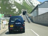
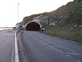
Entering the eastern bore. SOX lighting still present.
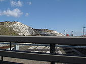
Originally uploaded to Coppermine on Oct 16, 2008 by sotonsteveThis tunnel was dug to allow access to Shakespeare Cliff for the abortive consruction of the 1970s Channel Tunnel, and it was used again to access the working site for the present Channel Tunnel at the base of Shakespeare Cliff. The spoil dug from the tunnel was used to create a new tract of land about 0.5km deep and 1.5km long; it has been designated a nature reserve and is open to the public for leisure such as walking or fishing The area is accessed through this same single-track tunnel.
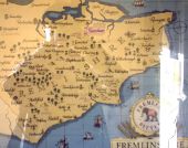
Originally uploaded to Coppermine on Oct 16, 2005 by Brenley CornerSeen on the wall of a pub in Seddlescombe (E Sussex) this map is strangely bereft of roads!
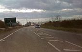
Originally uploaded to Coppermine on Feb 07, 2007 by agc2070A general view of the approach to Pegwell tunnel on the A299 Taken 17th June 2008.
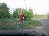
Originally uploaded to Coppermine on Jun 18, 2008 by YorklettsNote agreeable K(ent) C(ounty) D(istrict) logo on top of post. Originally uploaded to Coppermine on Jun 11, 2006 by Simon A6(M)
Sign is in Ivy Hatch - C2r, Mar 2016
Clocktower, Margate
Originally uploaded to Coppermine on May 28, 2008 by RoadKillStation Parade in Westgate is lit by Thorn Alpha 3s mounted on a mixture of sleeved and unsleeved CU concrete columns. However, the first installation on the road is a wall-mounted example. These are becoming ever rarer on many streets in Britain, and the Thanet, for one, is now no longer a place where Alpha 3s are common!
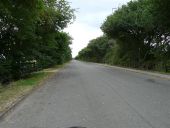
Originally uploaded to Coppermine on Oct 30, 2008 by RojojnrThe first few yards of Watling Street leading away towards Canterbury from Richborough Roman fort: the first stretch of Roman road constructed in Britain, now little more than a cart track.
OP Simon{A6(M)}
Originally uploaded to Coppermine on Apr 06, 2005 by M4SimonThe last installation on Sea Road before the junction with Westgate Bay Avenue is this MRL6 mounted on a sleeved concrete column. There is a remote geared MA90 with shoe opposite, but it lights the road at a very strange angle which is hard to photograph! It is also a survivor of the replacement scheme which occurred on Westgate Bay Avenue in 2006 involving Arcs, installed like the one shown on the left. The MA90s were only installed at 8m, but the Arcs have been mounted at 10m! Not good at all!
Originally uploaded to Coppermine on Oct 30, 2008 by Rojojnr