Gallery:M5 (Northern Ireland)
From Roader's Digest: The SABRE Wiki
Jump to navigation
Jump to search
Motorways in Northern Ireland > M5 (Northern Ireland)
This gallery has no child categories
M5 (Northern Ireland)
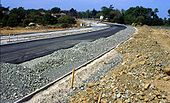
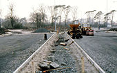
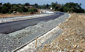
THE M5 - 27 YEARS AGO
The M5, at Rushpark, nearing completion on 24 May 1980. It opened four months later. For the history of this short stretch of motorway see http://www.wesleyjohnston.com/roads/m5.html.
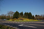
Originally uploaded to Coppermine on Nov 12, 2007 by Wee HughieRushpark roundabout, Whiteabbey
Rushpark roundabout is where the M5 joins the Shore Road, Whiteabbey. The M5 is in the foreground but the �End of Motorway� sign is behind the photographer. The view is towards Carrickfergus.
Rushpark roundabout is where the M5 joins the Shore Road, Whiteabbey. The M5 is in the foreground but the �End of Motorway� sign is behind the photographer. The view is towards Carrickfergus.
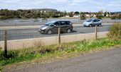
The M5 at Whitehouse
The coastal path from Hazelbank <a href='http://www.geograph.org.uk/photo/1814079'>J3580 : The Loughshore at Whitehouse</a> runs very close to the M5 <a href='http://www.geograph.org.uk/photo/1754964'>J3580 : The M5 near Rushpark, Whiteabbey</a> (southbound lanes nearest the camera). This is almost the same place as <a href='http://www.geograph.org.uk/photo/1814184'>J3580 : Loughshore whins, Whitehouse</a>.
The coastal path from Hazelbank <a href='http://www.geograph.org.uk/photo/1814079'>J3580 : The Loughshore at Whitehouse</a> runs very close to the M5 <a href='http://www.geograph.org.uk/photo/1754964'>J3580 : The M5 near Rushpark, Whiteabbey</a> (southbound lanes nearest the camera). This is almost the same place as <a href='http://www.geograph.org.uk/photo/1814184'>J3580 : Loughshore whins, Whitehouse</a>.
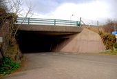
Motorway underpass near Whitehouse
The path, from Hazelbank Park to the Whitehouse Lagoon, passing under the M5 <a href='http://www.geograph.org.uk/photo/1754964'>J3580 : The M5 near Rushpark, Whiteabbey</a>.
The path, from Hazelbank Park to the Whitehouse Lagoon, passing under the M5 <a href='http://www.geograph.org.uk/photo/1754964'>J3580 : The M5 near Rushpark, Whiteabbey</a>.
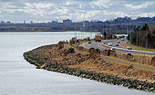
The M5 near Rushpark, Whiteabbey
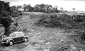
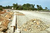
See <a href='http://www.geograph.org.uk/photo/1638178'>J3580 : Building the M5 near Rushpark, Whiteabbey (2)</a>. More than 30 years later the M5, close to the same place and looking towards Belfast, seen from Hazelbank Park.
See <a href='http://www.geograph.org.uk/photo/1638178'>J3580 : Building the M5 near Rushpark, Whiteabbey (2)</a>. More than 30 years later the M5, close to the same place and looking towards Belfast, seen from Hazelbank Park.
M2 FORTWILLIAM
The construction of an additional (southbound) lane from Sandyknowes to Greencastle and the closure of the northbound inside lane is having an effect on peak traffic flow. This queue is appx 2� miles long. Taken at 16.35 before the real peak flow had started. 28 September 2007. (This is a daily event M-F).
Originally uploaded to Coppermine on Nov 12, 2007 by Wee Hughie