Gallery:Manchester
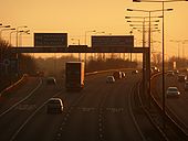
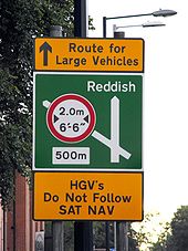
Sign at the exit. whats that? traffic lights? on the mainline? grrrrr......
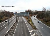
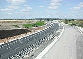
Originally uploaded to Coppermine on Feb 22, 2008 by RoadaddictReeceSlightly different from all of the winter themed pictures. It shows the M60 under construction anti-clockwise at junction 23 (Ashton).
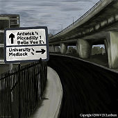
Originally uploaded to Coppermine on Jan 16, 2006 by DavidBrownNot a Photo, but a painting on which there was a thread in the forums.
It is based on a photo from 1967 showing Mancunian Way�the A57(M) and the surrounding effect of the brutalist architecture that scarred many cities at the time...
Originally uploaded to Coppermine on Jun 16, 2006 by LilIt's been a while since we've had a night (or even dusk) shot. Here's one taken over a couple of minutes last month, and blended together from 10 or 20 pictures.
Note that it has thumbnailed poorly - it's better at a reasonable size.
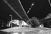
Originally uploaded to Coppermine on Apr 18, 2007 by bealach na baThe A57(M) as viewed from below at night taken on a very cold December evening.
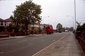
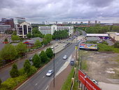
Originally uploaded to Coppermine on Jan 19, 2008 by LilLooking North along the A5063 (Trafford Road) in Salford, Greater Manchester.
Originally uploaded to Coppermine on Jun 16, 2009 by KevRA few things on here. All of the 'old' part of the Mancunian Way is complete, but it seams that the 'unfinished' slip is complete and connects with Brook St. Princess Road (A5103) doesn't yet meet it's Mancunian Way Junction, it also seams to have some sort of connector with Moss Lane planned? No Chester Road Flyover (the old Iron one) installed yet ether. Originally uploaded to Coppermine on Apr 04, 2005 by Mediaman_12
This page includes a scan of a non-free copyrighted map, and the copyright for it is most likely held by the company or person that produced the map. It is believed that the use of a limited number of web-resolution scans qualifies as fair use under United States copyright law, where this web page is hosted, as such display does not significantly impede the right of the copyright holder to sell the copyrighted material, is not being used to generate profit in this context, and presents information that cannot be exhibited otherwise.
If the copyright holder considers this is an infringement of their rights, please contact the Site Management Team to discuss further steps.
The comedians of Mancherster City Council attempt to hide the slip-road that never was by placing a huge M-way sign at where the A57(M) was to slip into Manchester City Centre but due to the one-way system in operation had to be aborted - a classic tale of slip-road tomfoolery.
Originally uploaded to Coppermine on Mar 26, 2007 by juzza76It's the A6 & A580 before all the GS junctions where added. Originally uploaded to Coppermine on Apr 04, 2005 by Mediaman_12
This page includes a scan of a non-free copyrighted map, and the copyright for it is most likely held by the company or person that produced the map. It is believed that the use of a limited number of web-resolution scans qualifies as fair use under United States copyright law, where this web page is hosted, as such display does not significantly impede the right of the copyright holder to sell the copyrighted material, is not being used to generate profit in this context, and presents information that cannot be exhibited otherwise.
If the copyright holder considers this is an infringement of their rights, please contact the Site Management Team to discuss further steps.
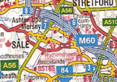
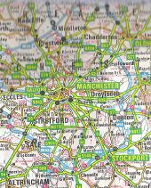
what the M60 collector distributer lanes look like in the new AtoZ GB atlas. also a downgraded A6144(M) *sniff* Originally uploaded to Coppermine on Jul 26, 2006 by sabristo simon
This page includes a scan of a non-free copyrighted map, and the copyright for it is most likely held by the company or person that produced the map. It is believed that the use of a limited number of web-resolution scans qualifies as fair use under United States copyright law, where this web page is hosted, as such display does not significantly impede the right of the copyright holder to sell the copyrighted material, is not being used to generate profit in this context, and presents information that cannot be exhibited otherwise.
If the copyright holder considers this is an infringement of their rights, please contact the Site Management Team to discuss further steps.
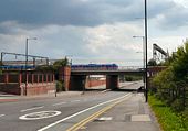
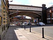
Two bridges at the southern end of Deansgate. The nearer of the two carries the Metrolink, whist the other carries the railway approaching Deansgate station.
A view of the junction of the A57(M) Mancunian Way and the A34 Upper Brook Street, showing the famous unfinished slip road. Originally linked to by Ste_Nova.
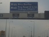
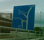
Originally uploaded to Coppermine on Nov 11, 2006 by PeterA5145Main sign on unused ramp
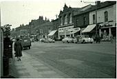
Originally uploaded to Coppermine on Sep 18, 2006 by snowdonManchester City Centre. Before the Arndale was built. The A6 comes up Piccadily, along Market St. & St Marys Gate, but Blackfriars St. does not have the heavy outline of a 'main' road, Where to now? Did it multiplex up Deansgate for a while?
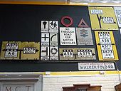
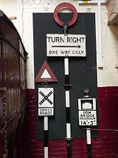
Originally uploaded to Coppermine on Apr 03, 2005 by Mediaman_12The Manchester Museum of Transport, Boyle St, has this excellent collection of pre-Worboys signs on display.
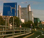
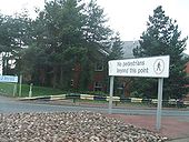
Originally uploaded to Coppermine on Nov 25, 2008 by leopard680Painted armco, No pedesrians sign, and large blue pedestrian direction sign in the distance.
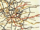
Originally uploaded to Coppermine on Mar 18, 2008 by Bryn666From Fina 5 miles = 1 inch sheet 3, c.1971
Originally uploaded to Coppermine on Aug 22, 2007 by FosseWay
This page includes a scan of a non-free copyrighted map, and the copyright for it is most likely held by the company or person that produced the map. It is believed that the use of a limited number of web-resolution scans qualifies as fair use under United States copyright law, where this web page is hosted, as such display does not significantly impede the right of the copyright holder to sell the copyrighted material, is not being used to generate profit in this context, and presents information that cannot be exhibited otherwise.
If the copyright holder considers this is an infringement of their rights, please contact the Site Management Team to discuss further steps.
Each road is dated with the year the road was turnpiked.
Map courtesy of the South Pennine Packhorse Trails Trust
Originally uploaded to Coppermine on Apr 05, 2008 by SchultThe stretch between Stockport and the M67 can be seen numbered as the M66. It also has an unbuilt spur. Also note the A6144(M) under construction. Originally uploaded to Coppermine on Nov 06, 2005 by DavidBrown
This page includes a scan of a non-free copyrighted map, and the copyright for it is most likely held by the company or person that produced the map. It is believed that the use of a limited number of web-resolution scans qualifies as fair use under United States copyright law, where this web page is hosted, as such display does not significantly impede the right of the copyright holder to sell the copyrighted material, is not being used to generate profit in this context, and presents information that cannot be exhibited otherwise.
If the copyright holder considers this is an infringement of their rights, please contact the Site Management Team to discuss further steps.
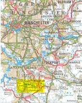
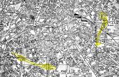
A street plan of unknown vintage, with the proposed Inner Ring Road highlighted (by me) in yellow. Originally uploaded to Coppermine on Aug 02, 2005 by bealach na ba
This page includes a scan of a non-free copyrighted map, and the copyright for it is most likely held by the company or person that produced the map. It is believed that the use of a limited number of web-resolution scans qualifies as fair use under United States copyright law, where this web page is hosted, as such display does not significantly impede the right of the copyright holder to sell the copyrighted material, is not being used to generate profit in this context, and presents information that cannot be exhibited otherwise.
If the copyright holder considers this is an infringement of their rights, please contact the Site Management Team to discuss further steps.
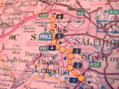
The motorway that doesnt know its own identity. The M62 in the days before it was changed twice to the M63 and M60.
OP Jonathan
Originally uploaded to Coppermine on Apr 21, 2005 by M4Simon
This page includes a scan of a non-free copyrighted map, and the copyright for it is most likely held by the company or person that produced the map. It is believed that the use of a limited number of web-resolution scans qualifies as fair use under United States copyright law, where this web page is hosted, as such display does not significantly impede the right of the copyright holder to sell the copyrighted material, is not being used to generate profit in this context, and presents information that cannot be exhibited otherwise.
If the copyright holder considers this is an infringement of their rights, please contact the Site Management Team to discuss further steps.
M62 Manchester This map shows a planned M601 heading south into Manchester from between the current M60 J16/J17. Now the M602 numbering makes more sense?????
OP Brenley Corner
Originally uploaded to Coppermine on Apr 16, 2005 by M4Simon